2023
SJ8403 : Farmland and railway south of Codsall Wood, Staffordshire
taken 1 year ago, near to Oaken, Staffordshire, England
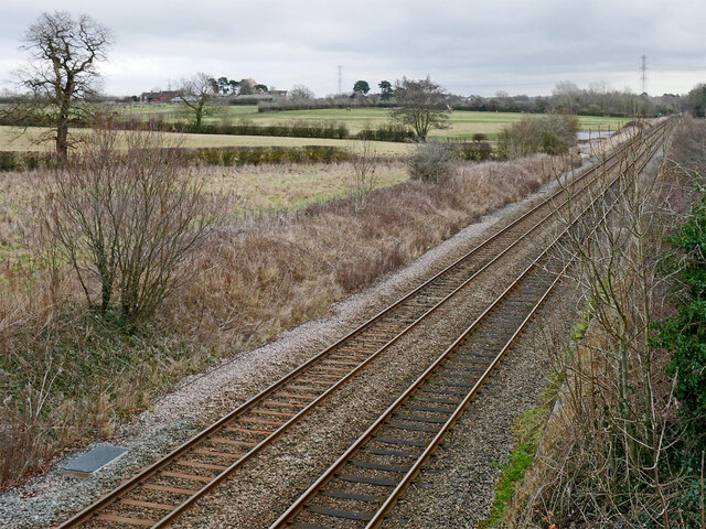
Farmland and railway south of Codsall Wood, Staffordshire
Looking east-north-east from the Monarch's Way on Husphins Bridge west of Codsall. Farm buildings at The Stockings are on the skyline.
The line was originally built by the Shrewsbury and Birmingham Railway company in 1849. This merged with the Great Western Railway in 1854. Some scheduled trains go beyond Shrewsbury to Chester, Holyhead, Pwllheli, Aberystwyth and Wrexham.
The line was originally built by the Shrewsbury and Birmingham Railway company in 1849. This merged with the Great Western Railway in 1854. Some scheduled trains go beyond Shrewsbury to Chester, Holyhead, Pwllheli, Aberystwyth and Wrexham.
 Map © Crown Copyright")
TIP: Click the map for more Large scale mapping
- Grid Square
- SJ8403, 39 images (more nearby 🔍)
- Photographer
- Roger D Kidd (more nearby)
- Date Taken
- Thursday, 26 January, 2023 (more nearby)
- Submitted
- Tuesday, 31 January, 2023
- Subject Location
-
OSGB36:
 SJ 8464 0376 [10m precision]
WGS84: 52:37.8824N 2:13.7026W - Camera Location
-
OSGB36: SJ 8449 0374
- View Direction
- EAST (about 90 degrees)