2023
TQ5178 : View from Erith Pier
taken 1 year ago, near to Erith, Bexley, England
This is 1 of 7 images, with title View from Erith Pier in this square
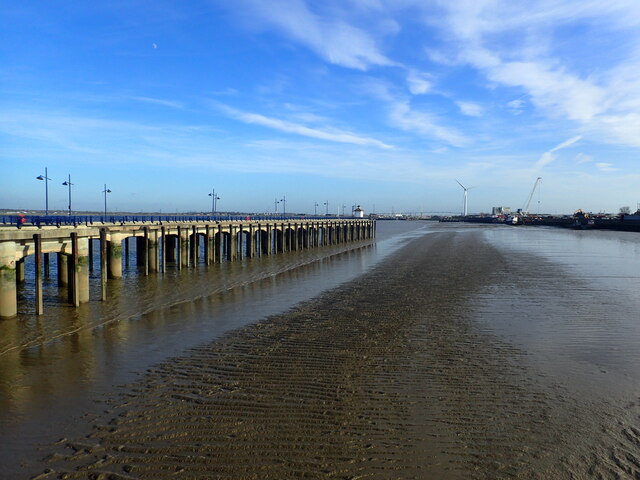
View from Erith Pier
Erith Pier is the longest pier in London. It was originally built for bringing coal ashore but was derelict for many years. It was restored and opened to the public by Morrisons as part of an agreement to build a supermarket nearby. This view from the pier looks towards the far end. The Queen Elizabeth II Bridge at Dartford can be seen in the far distance.
 Map © Crown Copyright")
TIP: Click the map for more Large scale mapping
- Grid Square
- TQ5178, 167 images (more nearby 🔍)
- Photographer
- Marathon (more nearby)
- Date Taken
- Monday, 30 January, 2023 (more nearby)
- Submitted
- Wednesday, 1 February, 2023
- Subject Location
-
OSGB36:
 TQ 5192 7813 [10m precision]
WGS84: 51:28.9036N 0:11.1861E - Camera Location
-
OSGB36: TQ 5173 7811
- View Direction
- EAST (about 90 degrees)