2023
TQ5178 : Erith Pier
taken 1 year ago, near to Erith, Bexley, England
This is 1 of 8 images, with title Erith Pier in this square
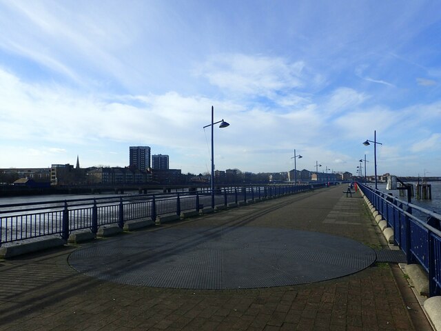
Erith Pier
Erith Pier is the longest pier in London. It was originally built for bringing coal ashore but was derelict for many years. It was restored and opened to the public by Morrisons as part of an agreement to build a supermarket nearby. Some of the features from when it was a coal wharf have been retained as here where the site of the old turntable can be seen. See also Link
 Map © Crown Copyright")
TIP: Click the map for more Large scale mapping
- Grid Square
- TQ5178, 167 images (more nearby 🔍)
- Photographer
- Marathon (more nearby)
- Date Taken
- Monday, 30 January, 2023 (more nearby)
- Submitted
- Wednesday, 1 February, 2023
- Subject Location
-
OSGB36:
 TQ 5181 7819 [10m precision]
WGS84: 51:28.9378N 0:11.0927E - Camera Location
-
OSGB36: TQ 5191 7814
- View Direction
- West-northwest (about 292 degrees)