J4482 : The North Down Coastal Path near Seahill
taken 1 year ago, near to Helen's Bay, Co Down, Northern Ireland
This is 1 of 4 images, with title The North Down Coastal Path near Seahill in this square
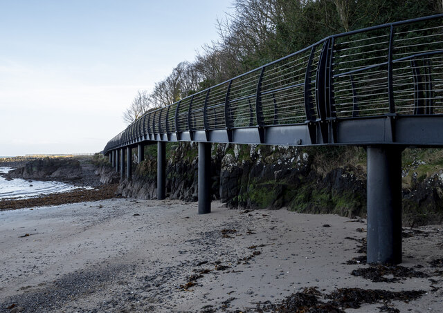
The North Down Coastal Path near Seahill
The bridge at Seahill, installed in 2015 and a fantastic improvement to this section of the path (see J4482 : Coastal path improvements, Helen's Bay - May 2015(1), J4482 : North Down Coastal Path and J4482 : North Down Coastal Path for context). It has aged well and nature has been allowed to reclaim the previous route over the rocks above.
The North Down Coastal Path
The North Down Coastal Path extends for some 16 miles between Holywood and Orlock in north County Down. Although it has always been possible to walk the entire route along the shoreline, prior to 1970 much of the area was still in private ownership. In the 1960s, the government, local councils and National Trust worked to together to get the path fully accessible and opened to all. This included, in many places, extensive works to create concrete and tarmac routes over what was the natural environment between Holywood and Bangor. Beyond Bangor it remains much wilder and unspoilt, particularly on the sections at Ballymacormick Point and Orlock. It was formally opened in 1971.
See Linkfor further information and maps.
![Creative Commons Licence [Some Rights Reserved]](https://s1.geograph.org.uk/img/somerights20.gif)
|
· Find out How to reuse this image ·
Share:
|
|||||
| Start a discussion on J4482 | Suggest an update to this image | Contact the contributor | |||
Loading map... (JavaScript required)
- Grid Square
- J4482, 121 images (more nearby
 )
)
- Photographer
- Rossographer (find more nearby)
- Date Taken
- Monday, 30 January, 2023 (more nearby)
- Submitted
- Monday, 6 February, 2023
- Geographical Context
- Primary Subject of Photo
- Structure (from Tags)
- Subject Location
-
Irish:
 J 4439 8247 [10m precision]
WGS84: 54:40.1783N 5:45.7614W - Camera Location
-
Irish: J 4435 8244
- View Direction
- Northeast (about 45 degrees)
Other Tags
This page has been viewed about 70 times.
View this location:
KML (Google Earth) ·
Google Maps ·
Bing Maps ·
Geograph Coverage Map ·
More Links for this image