2023
SO6317 : Boundary Stone, Ruardean Hill
taken 1 year ago, near to Drybrook, Gloucestershire, England
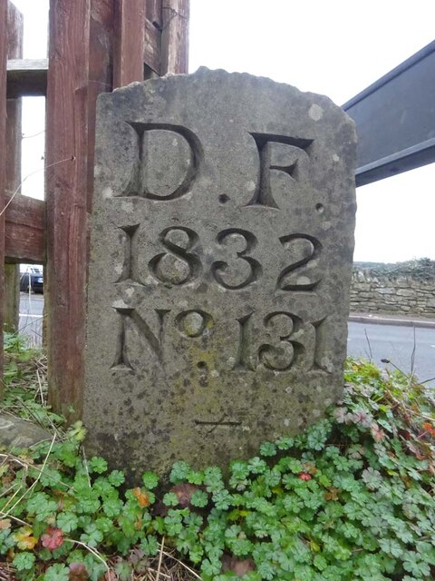
Boundary Stone, Ruardean Hill
Forest of Dean boundary stone at the apex of the junction between Batts Lane and Morse Road. Despit the date on the inscription, this is from a more recent century, probably the 20ᵗʰ.
Inscription: D. F. / 1832 / Nᴼ. 131 / ―
Milestone Society National ID: GL_DFDRYB131em
Inscription: D. F. / 1832 / Nᴼ. 131 / ―
Milestone Society National ID: GL_DFDRYB131em
Forest of Dean Boundary Stones
a list of 100 (so far, of 200) FoD BS on Geograph see Link . An interactive map of them is Link

Some are Gale (mining rights) Stones see Facebook Link
National Survey of Wayside Features by The Milestone Society
These images are from Link
 Map © Crown Copyright")
TIP: Click the map for more Large scale mapping
- Grid Square
- SO6317, 36 images (more nearby 🔍)
- Photographer
- Mr Red (more nearby)
- Date Taken
- Saturday, 4 February, 2023 (more nearby)
- Submitted
- Monday, 6 February, 2023
- Subject Location
-
OSGB36:
 SO 63981 17157 [1m precision]
WGS84: 51:51.1101N 2:31.4603W - Camera Location
-
OSGB36: SO 63981 17157
- View Direction
- Northeast (about 45 degrees)