2023
SN7178 : Site of Gwaith-goch mine
taken 1 year ago, near to Cwmbrwyno, Ceredigion/Sir Ceredigion, Wales
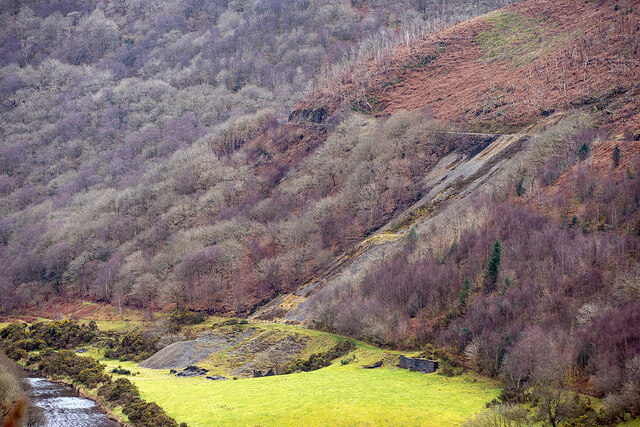
Site of Gwaith-goch mine
Viewed from the Coed Dol-fawr lookout. Waste from the mine remains visible in the lower left. Afon Rheidol is just visible in the far bottom left. The Vale of Rheidol Railway trackbed runs across the upper right of the view, finally disappearing from sight as it curves sharply into Cwm Rhiwrugos. Top left is the extensive sessile oak woodland of Coed Rheidol Nature Reserve.
 Map © Crown Copyright")
TIP: Click the map for more Large scale mapping
- Grid Square
- SN7178, 249 images (more nearby 🔍)
- Photographer
- John Lucas (more nearby)
- Date Taken
- Monday, 27 February, 2023 (more nearby)
- Submitted
- Tuesday, 28 February, 2023
- Subject Location
-
OSGB36:
 SN 7103 7870 [10m precision]
WGS84: 52:23.4652N 3:53.7997W - Camera Location
-
OSGB36: SN 7063 7945
- View Direction
- South-southeast (about 157 degrees)