2009
SD9600 : Old Boundary Marker on Mossley Road, Hazelhurst
taken 15 years ago, near to Hurst, Tameside, England
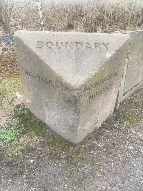
Old Boundary Marker on Mossley Road, Hazelhurst
Municipal Boundary Marker at the end of a concrete wall on the east side of the A670 Mossley Road in Hazelhurst. Previously Ashton under Lyne parish until 1894, then on the boundary of Hartshead parish, created 1894, and Mossley borough and parish. Now entirely in Tameside. See also Link.
Milestone Society National ID: LA_HARMOS01pb
Milestone Society National ID: LA_HARMOS01pb
National Survey of Wayside Features by The Milestone Society
These images are from Link
 Map © Crown Copyright")
TIP: Click the map for more Large scale mapping
- Grid Square
- SD9600, 30 images (more nearby 🔍)
- Photographer
- N Upton (more nearby)
- Contributed by
- Milestone Society (more nearby)
- Date Taken
- 2009 (more nearby)
- Submitted
- Wednesday, 1 March, 2023
- Subject Location
-
OSGB36:
 SD 96237 00712 [1m precision]
WGS84: 53:30.1852N 2:3.4921W - Camera Location
-
OSGB36: SD 96237 00712
- View Direction
- Southeast (about 135 degrees)