2023
NZ6514 : Old Boundary Marker near Aysdale Gate Farmhouse
taken 1 year ago, near to Charltons, Redcar And Cleveland, England
This is 1 of 4 images, with title Old Boundary Marker near Aysdale Gate Farmhouse in this square
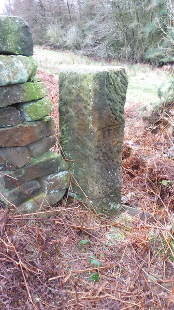
Old Boundary Marker near Aysdale Gate Farmhouse
Estate Boundary Marker beside a wall gate on Stanghow Moor 350 metres southeast of Aysdale Gate Farmhouse and south of the A171 Birk Brow road. On the boundary of the Skelton and Guisborough estates. Formerly in Stanghow township in Skelton parish, then Stanghow parish from 1866, and Lockwood parish from 1982. Grade II Listed details Link .
.
Milestone Society National ID: YN_LOCK16em
Milestone Society National ID: YN_LOCK16em
National Survey of Wayside Features by The Milestone Society
These images are from Link
 Map © Crown Copyright")
TIP: Click the map for more Large scale mapping
- Grid Square
- NZ6514, 30 images (more nearby 🔍)
- Photographer
- Mike Rayner (more nearby)
- Date Taken
- Thursday, 2 March, 2023 (more nearby)
- Submitted
- Thursday, 2 March, 2023
- Subject Location
-
OSGB36:
 NZ 65376 14545 [1m precision]
WGS84: 54:31.3193N 0:59.4897W - Camera Location
-
OSGB36: NZ 65376 14545