2022
SP3278 : Buses here, Coventry station
taken 2 years ago, near to Coventry, England
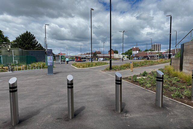
Buses here, Coventry station
Buses that call at Coventry station now do it here a circuit off the Warwick Road ringed by bus shelters (there are four in the photo). What to call it? Maps don't help. Bus station? Hardly. Bus stop zone? Bus hub? It is necessary and undeniably spacious, an improvement on the cramped bus stops at the 1960s station. Bus interchange, that's it, reached on foot from the new station concourse by a level footway under the Warwick Road, seen on the right in SP3278 : New bus interchange, Coventry Station.
 Map © Crown Copyright")
TIP: Click the map for more Large scale mapping
- Grid Square
- SP3278, 387 images (more nearby 🔍)
- Photographer
- Robin Stott (more nearby)
- Date Taken
- Wednesday, 8 June, 2022 (more nearby)
- Submitted
- Thursday, 16 March, 2023
- Subject Location
-
OSGB36:
 SP 3299 7826 [10m precision]
WGS84: 52:24.0818N 1:30.9924W - Camera Location
-
OSGB36: SP 3303 7825
- View Direction
- West-northwest (about 292 degrees)