SU5516 : Upcoming solar farm on land at Locks Farm
taken 1 year ago, near to Bishop's Waltham, Hampshire, England
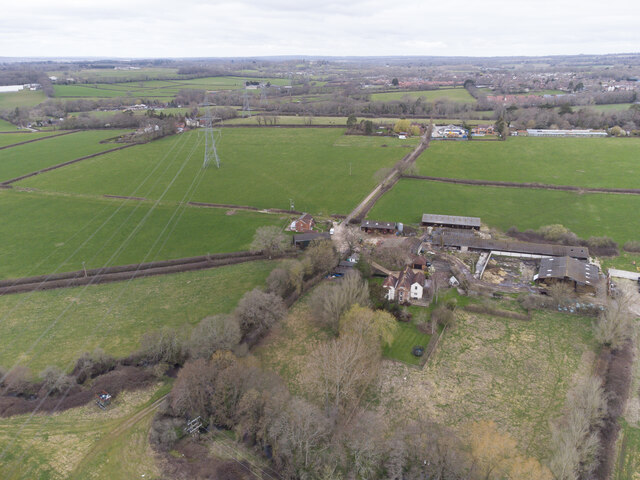
In March 2021 planning application 21/01391/FUL was made by Intelligent Alternatives on behalf of NextEnergy for an 18 MW solar farm on land at Locks Farm, Bishop's Waltham.
It was estimated to employ 53,333 solar panels on tables between 0.8 and 3m above ground so that sheep could graze beneath them. A gap of 3.2m would be allowed between rows of panels to facilitate maintenance and agriculture.
The solar farm would also include a battery energy storage facility (BESS) in five large shipping containers so that unwanted solar power could be stored and released later to the grid. The BESS feature proved to be the most contentious to the local residents and it was removed from the application on 22nd September 2022.
About nine inverter/transformer cabins would be located around the site, together with switchgear and substation buildings and a 15m tall mast. Connection to the grid would be via an existing 33 KV line running across the site from Bishop's Waltham to Eastleigh substations.
Permission for the development was finally granted by Winchester City Council's planning committee on 15th March 2023. See Hampshire Chronicle article Link. There were no less than 286 documents attached to this planning application which took two years to get through the planning system.
The drone photos show the state of the affected farm land immediately before the development began.
 Map © Crown Copyright")
- Grid Square
- SU5516, 10 images (more nearby 🔍)
- Photographer
- Peter Facey (more nearby)
- Date Taken
- Sunday, 19 March, 2023 (more nearby)
- Submitted
- Sunday, 19 March, 2023
- Subject Location
-
OSGB36:
 SU 5509 1646 [10m precision]
WGS84: 50:56.6973N 1:13.0332W - Camera Location
-
OSGB36: SU 55216 16295
- View Direction
- Northwest (about 315 degrees)