2023
SE0026 : Old Boundary Marker in Crow Nest Wood
taken 1 year ago, near to Hebden Bridge, Calderdale, England
This is 1 of 5 images, with title starting with Old in this square
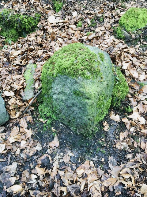
Old Boundary Marker in Crow Nest Wood
Parish Boundary Marker in Crow Nest Wood. Formerly on the boundary of Erringden and Sowerby townships in Halifax parish. It marked the boundary of the Sowerby Ramble, a narrow strip of land along the Calder valley and up Stoodley Glen between Erringden and Stansfield townships and Erringden and Langfield townsships. Sowerby Ramble was part of Sowerby township but in 1850 it became part of Erringden township, later parish. This marker is now entirely in Hebden Royd parish.
Milestone Society National ID: YW_ERRSOW04pb
Milestone Society National ID: YW_ERRSOW04pb
National Survey of Wayside Features by The Milestone Society
These images are from Link
 Map © Crown Copyright")
TIP: Click the map for more Large scale mapping
- Grid Square
- SE0026, 333 images (more nearby 🔍)
- Photographer
- D Garside (more nearby)
- Contributed by
- Milestone Society (more nearby)
- Date Taken
- March 2023 (more nearby)
- Submitted
- Monday, 20 March, 2023
- Subject Location
-
OSGB36:
 SE 00069 26459 [1m precision]
WGS84: 53:44.0713N 2:0.0260W - Camera Location
-
OSGB36: SE 00069 26459