2023
SN1646 : Capel Degwel, St. Dogmael's
taken 1 year ago, near to St Dogmaels, Pembrokeshire/Sir Benfro, Wales
This is 1 of 2 images, with title Capel Degwel, St. Dogmael's in this square
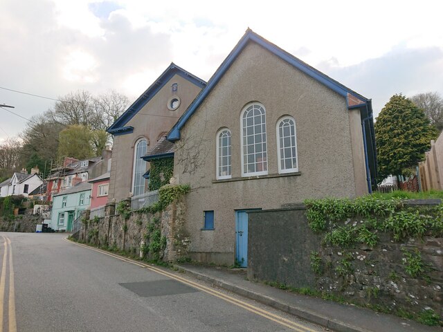
Capel Degwel, St. Dogmael's
The wall in front of the chapel bore an Ordnance Survey benchmark where it joins the angle of the chapel:
Height: 20.342m OD (Newlyn). Mark verified by the Ordnance Survey in 1954. Description: WALL JUNC CAPEL DEGWEL W SIDE RD. 0.5m above ground. 3rd Order BM. SN 1628 4645
From the South-west: SN1646 : Capel Degwel, St. Dogmael's
Height: 20.342m OD (Newlyn). Mark verified by the Ordnance Survey in 1954. Description: WALL JUNC CAPEL DEGWEL W SIDE RD. 0.5m above ground. 3rd Order BM. SN 1628 4645
From the South-west: SN1646 : Capel Degwel, St. Dogmael's
 Map © Crown Copyright")
TIP: Click the map for more Large scale mapping
- Grid Square
- SN1646, 89 images (more nearby 🔍)
- Photographer
- N Scott (more nearby)
- Date Taken
- Tuesday, 18 April, 2023 (more nearby)
- Submitted
- Tuesday, 18 April, 2023
- Subject Location
-
OSGB36:
 SN 1628 4645 [10m precision]
WGS84: 52:5.1498N 4:40.9720W - Camera Location
-
OSGB36: SN 1629 4646
- View Direction
- West-southwest (about 247 degrees)