SH7850 : Nave of St Tudclud's church
taken 11 months ago, near to Penmachno, Conwy, Wales
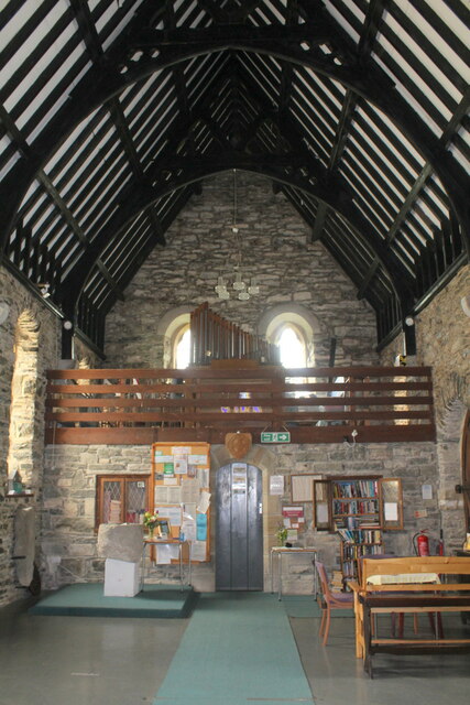
St Tudclud was a sixth century Saint, one of the five sons of Seithennyr Said. When the present church was built in 1859 a previous church of about 1600-20 was taken down. That church was on the site of the present chancel. There were also ruined walls of a 12th century church. This building was at the eastern end of the churchyard. The stones from both these earlier churches were used to line the present one. "The Penmachno Stones" (originating from the first Roman camp in Penmachno) were found in the walls of the 12th Century church. The existing font is a 12th century one from the first known church. Source: Link
The church was closed in 1997 and declared redundant in 1998, but with the will of the local village community it reopened in 2009 the first church of the Church in Wales to be reopened from a redundant state. Monthly services are held in the church which is open to visitors on most days, and there is a self service coffee shop and small shop in the church.
Further information can be found on the History points website: Link
 Map © Crown Copyright")
- Grid Square
- SH7850, 114 images (more nearby 🔍)
- Photographer
- Richard Hoare (more nearby)
- Date Taken
- Saturday, 6 May, 2023 (more nearby)
- Submitted
- Monday, 15 May, 2023
- Subject Location
-
OSGB36:
 SH 7898 5059 [10m precision]
WGS84: 53:2.3309N 3:48.3839W - Camera Location
-
OSGB36: SH 7898 5059
- View Direction
- West-southwest (about 247 degrees)