2023
SJ8838 : Trent & Mersey Canal, Barlaston
taken 11 months ago, near to Barlaston, Staffordshire, England
This is 1 of 2 images, with title Trent & Mersey Canal, Barlaston in this square
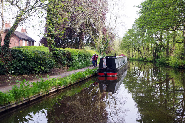
Trent & Mersey Canal, Barlaston
Two dog walkers stroll pass a moored narrowboat to the north of the Plume of Feathers bridge.
Trent and Mersey Canal
The Trent and Mersey Canal is 93·5 miles in length from Derwent Mouth to Preston Brook. The first cut was made by Josiah Wedgwood in July 1766 at Middleport (Stoke-on-Trent). The eastern section between Derwent Mouth and Shugborough (the junction with the Staffordshire and Worcestershire Canal) was already operational by 1770 and the whole canal through to Preston Brook, where it linked with the Bridgewater Canal was open for business by 1777. James Brindley was the engineer until his death in 1772. There are seventy-six locks en route to raise and lower the water level where hills impede the course. There are four tunnels, including the famous Harecastle Tunnel near Stoke-on-Trent.
 Map © Crown Copyright")
TIP: Click the map for more Large scale mapping
- Grid Square
- SJ8838, 87 images (more nearby 🔍)
- Photographer
- Stephen McKay (more nearby)
- Date Taken
- Sunday, 14 May, 2023 (more nearby)
- Submitted
- Saturday, 20 May, 2023
- Subject Location
-
OSGB36:
 SJ 8873 3840 [10m precision]
WGS84: 52:56.5721N 2:10.1492W - Camera Location
-
OSGB36: SJ 8873 3838
- View Direction
- NORTH (about 0 degrees)