2023
NN4806 : The Loch Katrine Dam
taken 11 months ago, 5 km W of Brig O'turk, Stirling, Scotland
This is 1 of 4 images, with title The Loch Katrine Dam in this square
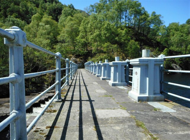
The Loch Katrine Dam
Sluice operating machinery for the 13 sluices of the dam. Also known as the Achray Dam, the original dam was constructed around 1857. It was rebuilt in 1902 when the water level of Loch Katrine was raised; and again in 1919, when it was raised again. It controls the flow of water from the loch to Loch Achray (hence the name, Achray Dam). It is Category C listed Link .
.
 Map © Crown Copyright")
TIP: Click the map for more Large scale mapping
- Grid Square
- NN4806, 31 images (more nearby 🔍)
- Photographer
- Richard Sutcliffe (more nearby)
- Date Taken
- Thursday, 25 May, 2023 (more nearby)
- Submitted
- Friday, 26 May, 2023
- Subject Location
-
OSGB36:
 NN 4896 0673 [10m precision]
WGS84: 56:13.7435N 4:26.2793W - Camera Location
-
OSGB36: NN 4899 0672
- View Direction
- WEST (about 270 degrees)