2023
SE7399 : Old Boundary Marker on Rosedale Moor
taken 11 months ago, 4 km NNE of Rosedale Abbey, North Yorkshire, England
This is 1 of 4 images, with title Old Boundary Marker on Rosedale Moor in this square
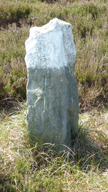
Old Boundary Marker on Rosedale Moor
Parish Boundary Marker on Rosedale Moor 450 metres west of Shunner Howe. Inscribed D and R on opposite faces. On the former boundary of Rosedale and Danby parishes but now on the boundary of Rosedale East Side and Glaisdale.
Milestone Society National ID: YN_RESGLA10pb
Milestone Society National ID: YN_RESGLA10pb
National Survey of Wayside Features by The Milestone Society
These images are from Link
 Map © Crown Copyright")
TIP: Click the map for more Large scale mapping
- Grid Square
- SE7399, 10 images (more nearby 🔍)
- Photographer
- Mike Rayner (more nearby)
- Date Taken
- Friday, 26 May, 2023 (more nearby)
- Submitted
- Saturday, 27 May, 2023
- Subject Location
-
OSGB36:
 SE 73294 99864 [1m precision]
WGS84: 54:23.3397N 0:52.3693W - Camera Location
-
OSGB36: SE 73294 99864