2023
SN2039 : Ordnance Survey Cut Mark
taken 11 months ago, near to Boncath, Pembrokeshire/Sir Benfro, Wales
This is 1 of 2 images, with title Ordnance Survey Cut Mark in this square
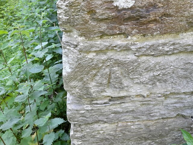
Ordnance Survey Cut Mark
This OS cut mark can be found on the NW angle of St Michael's Church. It marks a point 123.478m above mean sea level. Link
 Map © Crown Copyright")
TIP: Click the map for more Large scale mapping
- Grid Square
- SN2039, 5 images (more nearby 🔍)
- Photographer
- Adrian Dust (more nearby)
- Date Taken
- Saturday, 27 May, 2023 (more nearby)
- Submitted
- Saturday, 27 May, 2023
- Subject Location
-
OSGB36:
 SN 2084 3947 [10m precision]
WGS84: 52:1.4781N 4:36.7636W - Camera Location
-
OSGB36: SN 2084 3947
- View Direction
- EAST (about 90 degrees)