J3574 : Sydenham Road, Belfast
taken 16 years ago, near to Belfast, Co Antrim, Northern Ireland
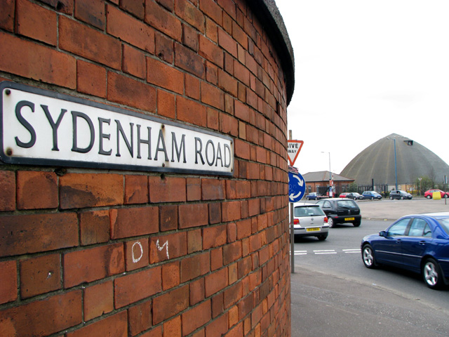
Sydenham Road, Belfast
Street sign for the Sydenham Road on the edge of the docks and the emerging 'Titanic Quarter'. Over the roundabout beyond is a salt barn used for storing rock salt by the Roads Service of Northern Ireland - see J3574 : Salt barn, Belfast.
![Creative Commons Licence [Some Rights Reserved]](https://s1.geograph.org.uk/img/somerights20.gif)
|
· Find out How to reuse this image ·
Share:
|
|||||
| Start a discussion on J3574 | Suggest an update to this image | Contact the contributor | |||
Loading map... (JavaScript required)
- Grid Square
- J3574, 516 images (more nearby
 )
)
- Photographer
- Rossographer (find more nearby)
- Date Taken
- Thursday, 3 April, 2008 (more nearby)
- Submitted
- Friday, 4 April, 2008
- Category
- Road signs (more nearby)
- Subject Location
-
Irish:
 J 357 748 [100m precision]
WGS84: 54:36.2065N 5:53.9656W - Camera Location
-
Irish: J 357 748
- View Direction
- East-northeast (about 67 degrees)
Image classification(about):
Supplemental image
This page has been viewed about 133 times.
View this location:
KML (Google Earth) ·
Google Maps ·
Bing Maps ·
Geograph Coverage Map ·
More Links for this image
·
Bing Maps ·
Geograph Coverage Map ·
More Links for this image