2023
ST4756 : Ordnance Survey Rivet
taken 10 months ago, near to Burrington, North Somerset, England
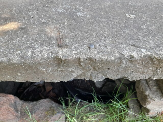
Ordnance Survey Rivet
This OS rivet can be found on the east face of the WWII Shelter. It marks a point 300.329m above mean sea level.
 Map © Crown Copyright")
TIP: Click the map for more Large scale mapping
- Grid Square
- ST4756, 43 images (more nearby 🔍)
- Photographer
- Adrian Dust (more nearby)
- Date Taken
- Tuesday, 30 May, 2023 (more nearby)
- Submitted
- Wednesday, 31 May, 2023
- Subject Location
-
OSGB36:
 ST 4716 5686 [10m precision]
WGS84: 51:18.5034N 2:45.5662W - Camera Location
-
OSGB36: ST 4716 5686
- View Direction
- WEST (about 270 degrees)