J3273 : The Westlink, Belfast (16)
taken 16 years ago, near to Belfast, Co Antrim, Northern Ireland
This is 1 of 10 images, with title starting with The Westlink, Belfast in this square
The Westlink, Belfast (16)
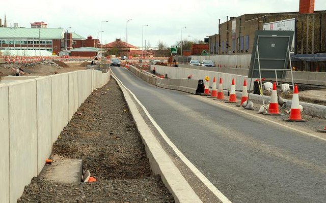
See J3273 : The Westlink, Belfast (15). Work is advanced on the underpass (left) to replace the Broadway roundabout. The view is towards the M2. My understanding is that there will be a south-bound off-slip (middle) and a segregated bus lane (right). With all the changes, the Google map has ceased to have much relevance.
![Creative Commons Licence [Some Rights Reserved]](https://s1.geograph.org.uk/img/somerights20.gif)
|
· Find out How to reuse this image ·
Share:
|
|||||
| Start a discussion on J3273 | Suggest an update to this image | Contact the contributor | |||
Loading map... (JavaScript required)
- Grid Square
- J3273, 167 images (more nearby
 )
)
- Photographer
- Albert Bridge (find more nearby)
- Date Taken
- Sunday, 6 April, 2008 (more nearby)
- Submitted
- Sunday, 6 April, 2008
- Category
- Road construction (more nearby)
- Subject Location
-
Irish:
 J 321 731 [100m precision]
WGS84: 54:35.3705N 5:57.4063W - Camera Location
-
Irish: J 321 731
- View Direction
- North-northeast (about 22 degrees)
Image classification(about):
Geograph
This page has been viewed about 102 times.
View this location:
KML (Google Earth) ·
Google Maps ·
Bing Maps ·
Geograph Coverage Map ·
More Links for this image
·
Bing Maps ·
Geograph Coverage Map ·
More Links for this image