2008
NT1379 : Inchgarvie and its forts
taken 16 years ago, near to North Queensferry, Fife, Scotland
This is 1 of 11 images, with title starting with Inchgarvie in this square
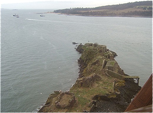
Inchgarvie and its forts
Seen from the rail bridge over the Forth. Hound Point and the offshore Tanker Berths are to be seen to the left rear.
 Map © Crown Copyright")
TIP: Click the map for more Large scale mapping
- Grid Square
- NT1379, 194 images (more nearby 🔍)
- Photographer
- Stanley Howe (more nearby)
- Date Taken
- Saturday, 15 March, 2008 (more nearby)
- Submitted
- Wednesday, 23 April, 2008
- Subject Location
-
OSGB36:
 NT 137 795 [100m precision]
WGS84: 56:0.0392N 3:23.1203W - Camera Location
-
OSGB36: NT 134 794
- View Direction
- EAST (about 90 degrees)