J4682 : The shore at Crawfordsburn (2)
taken 16 years ago, near to Helen's Bay, Co Down, Northern Ireland
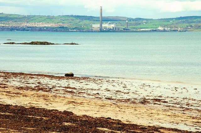
The shore at Crawfordsburn (2)
See J4682 : The shore at Crawfordsburn (1). The shore at Crawfordsburn with Kilroot power station J4388 : Kilroot power station, Carrickfergus visible, in the background, on the Co Antrim side of Belfast Lough.
![Creative Commons Licence [Some Rights Reserved]](https://s1.geograph.org.uk/img/somerights20.gif)
|
· Find out How to reuse this image ·
Share:
|
|||||
| Start a discussion on J4682 | Suggest an update to this image | Contact the contributor | |||
Loading map... (JavaScript required)
- Grid Square
- J4682, 146 images (more nearby
 )
)
- Photographer
- Albert Bridge (find more nearby)
- Date Taken
- Thursday, 1 May, 2008 (more nearby)
- Submitted
- Thursday, 1 May, 2008
- Category
- Coastline/Beaches (more nearby)
- Subject Location
-
Irish:
 J 467 824 [100m precision]
WGS84: 54:40.1488N 5:43.5957W - Camera Location
-
Irish: J 467 824
- View Direction
- North-northwest (about 337 degrees)
Image classification(about):
Geograph
This page has been viewed about 65 times.
View this location:
KML (Google Earth) ·
Google Maps ·
Bing Maps ·
Geograph Coverage Map ·
More Links for this image
·
Bing Maps ·
Geograph Coverage Map ·
More Links for this image