2008
NS5501 : The Water of Deugh
taken 16 years ago, near to Water of Deugh [water Feature], Dumfries And Galloway, Great Britain
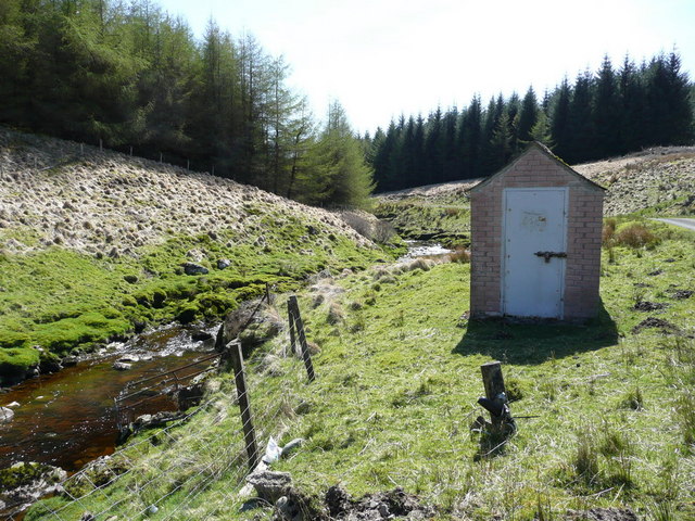
The Water of Deugh
The Water of Deugh. The building on the right is connected to water level measuring equipment on the bridge for the Galloway hydro electric scheme.
 Map © Crown Copyright")
TIP: Click the map for more Large scale mapping
- Grid Square
- NS5501, 4 images (more nearby 🔍)
- Photographer
- david johnston (more nearby)
- Date Taken
- Monday, 5 May, 2008 (more nearby)
- Submitted
- Friday, 9 May, 2008
- Subject Location
-
OSGB36:
 NS 557 015 [100m precision]
WGS84: 55:17.2028N 4:16.3473W - Camera Location
-
OSGB36: NS 557 014
- View Direction
- North-northeast (about 22 degrees)