2008
SZ4896 : Egypt Point Navigation Light
taken 16 years ago, near to Gurnard, Isle of Wight, England
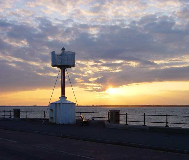
Egypt Point Navigation Light
Situated on Egypt Esplanade at the northernmost point in Cowes, this navigation light bears a plaque with the following inscription:
EGYPT POINT
First established by the Corporation of Trinity House in 1897, the light exhibited from Egypt Point provided a guide to those navigating in the Solent for almost a century until 1989 when the changing requirements of the Mariner led to the light being discontinued
The name "Egypt" is thought to derive from a colony of gypsies (then called "Egyptians") who lived in the area in the sixteenth century
 Map © Crown Copyright")
TIP: Click the map for more Large scale mapping
- Grid Square
- SZ4896, 235 images (more nearby 🔍)
- Photographer
- Euchiasmus (more nearby)
- Date Taken
- Sunday, 18 May, 2008 (more nearby)
- Submitted
- Monday, 26 May, 2008
- Subject Location
-
OSGB36:
 SZ 4848 9663 [10m precision]
WGS84: 50:46.0344N 1:18.8352W - Camera Location
-
OSGB36: SZ 4850 9662
- View Direction
- West-northwest (about 292 degrees)