2008
SO9199 : Wednesfield Road
taken 16 years ago, near to Wolverhampton, England
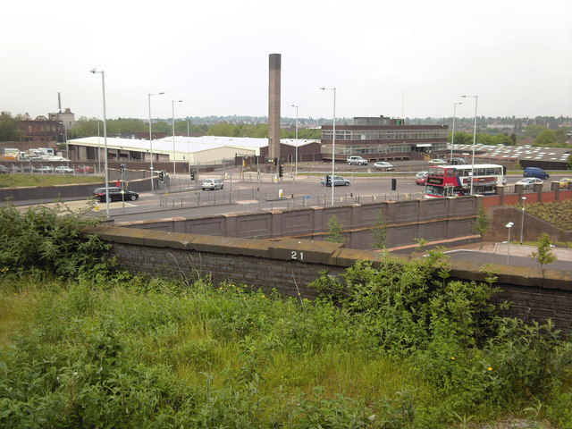
Wednesfield Road.
Junction with Culwell Street.The remains of Springfield brewery top left.
 Map © Crown Copyright")
TIP: Click the map for more Large scale mapping
- Grid Square
- SO9199, 676 images (more nearby 🔍)
- Photographer
- Annette Randle (more nearby)
- Date Taken
- Thursday, 29 May, 2008 (more nearby)
- Submitted
- Friday, 30 May, 2008
- Subject Location
-
OSGB36:
 SO 919 990 [100m precision]
WGS84: 52:35.3515N 2:7.2154W - Camera Location
-
OSGB36: SO 919 990
- View Direction
- North-northeast (about 22 degrees)