2008
SU1490 : Blunsdon by-pass site, Blunsdon 01.07.2008
taken 16 years ago, near to Broad Blunsdon, Swindon, England
This is 1 of 3 images, with title Blunsdon by-pass site, Blunsdon 01.07.2008 in this square
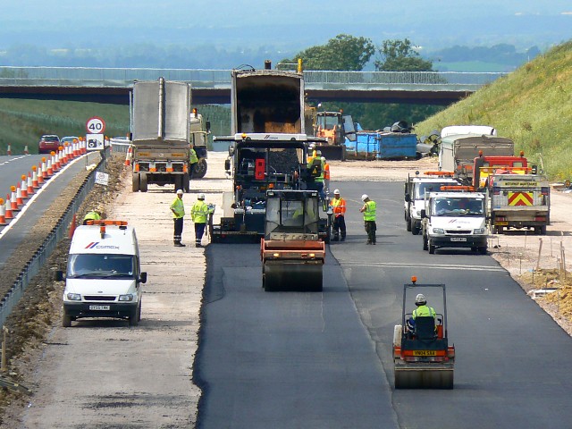
Blunsdon by-pass site, Blunsdon 01.07.2008
Taken on the day the north-bound carriageway opened for traffic, this telephoto image shows work continuing on the south-bound equivalent. This will take longer to complete probably because of the complexity of the work necessary to take the by-pass through the Turnpike junction behind the viewpoint.
 Map © Crown Copyright")
TIP: Click the map for more Large scale mapping
- Grid Square
- SU1490, 59 images (more nearby 🔍)
- Photographer
- Brian Robert Marshall (more nearby)
- Date Taken
- Tuesday, 1 July, 2008 (more nearby)
- Submitted
- Tuesday, 1 July, 2008
- Subject Location
-
OSGB36:
 SU 1451 9022 [10m precision]
WGS84: 51:36.6377N 1:47.5113W - Camera Location
-
OSGB36: SU 1472 8997
- View Direction
- Northwest (about 315 degrees)