2003
SX1496 : Crackington Haven
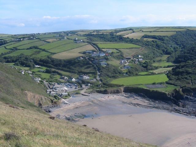
taken 21 years ago, near to Crackington Haven, Cornwall, England
This is 1 of 10 images, with title Crackington Haven in this square
Crackington Haven
Taken from the cliff around SX140972, but covering a good proportion of the SX1496 grid square with Crackington Haven nestling at the bottom of the valley. This was taken in 2003, before the 2004 floods which washed away the car park and footbridge.
 Map © Crown Copyright")
TIP: Click the map for more Large scale mapping
- Grid Square
- SX1496, 83 images (more nearby 🔍)
- Photographer
- Paul Dixon (more nearby)
- Date Taken
- August 2003 (more nearby)
- Submitted
- Wednesday, 9 March, 2005
- Subject Location
-
OSGB36:
 SX 14 96 [1000m precision]
WGS84: 50:44.3046N 4:37.8187W