V2460 : Path to Christ's Saddle, Skellig Michael
taken 20 years ago, 17 km WSW of Keel, Co Kerry, Ireland
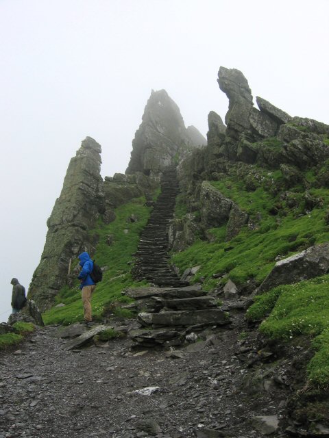
Path to Christ's Saddle, Skellig Michael
This is the steep path that leads up to Christ's Saddle. (The upper section of the path, from there to the monastery is shown on V2460 : Looking NE from Christ's Saddle on Skellig Michael..)
![Creative Commons Licence [Some Rights Reserved]](https://s1.geograph.org.uk/img/somerights20.gif)
|
· Find out How to reuse this image ·
Share:
|
|||||
| Start a discussion on V2460 | Suggest an update to this image | Contact the contributor | |||
Loading map... (JavaScript required)
- Grid Square
- V2460, 34 images (more nearby
 )
)
- Photographer
- Rob Burke (find more nearby)
- Date Taken
- Saturday, 8 May, 2004 (more nearby)
- Submitted
- Wednesday, 16 July, 2008
- Category
- Path > Path (more nearby)
- Subject Location
-
Irish:
 V 247 605 [100m precision]
WGS84: 51:46.1947N 10:32.4193W - Camera Location
-
Irish: V 247 605
- View Direction
- NORTH (about 0 degrees)
Image classification(about):
Geograph
This page has been viewed about 313 times.
View this location:
KML (Google Earth) ·
Google Maps ·
Bing Maps ·
Geograph Coverage Map ·
More Links for this image
·
Bing Maps ·
Geograph Coverage Map ·
More Links for this image