C6440 : Armillary Sphere Monument
taken 16 years ago, near to Greencastle, Co Donegal, Ireland
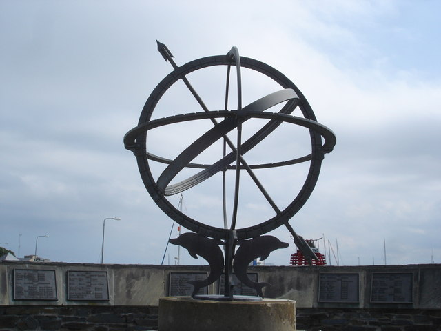
Armillary Sphere Monument
An ancient astronomical instrument used until the 17th Century is a monument to all the local sailors and fishermen drowned in the area of Lough Foyle from 1771 till 1995. Reference is made to "Black Saturday" in November 1771 when a fishing fleet went down with one hundred men. One survived. The masts of the current fishing fleet can be glimpsed above the wall.
![Creative Commons Licence [Some Rights Reserved]](https://s1.geograph.org.uk/img/somerights20.gif)
|
· Find out How to reuse this image ·
Share:
|
|||||
| Start a discussion on C6440 | Suggest an update to this image | Contact the contributor | |||
Loading map... (JavaScript required)
- Grid Square
- C6440, 92 images (more nearby
 )
)
- Photographer
- Kay Atherton (find more nearby)
- Date Taken
- Saturday, 26 July, 2008 (more nearby)
- Submitted
- Monday, 4 August, 2008
- Category
- Monument > Monument (more nearby)
- Subject Location
-
Irish:
 C 6463 4003 [10m precision]
WGS84: 55:12.1873N 6:59.1420W - Camera Location
-
Irish: C 6463 4003
- View Direction
- EAST (about 90 degrees)
Image classification(about):
Supplemental image
This page has been viewed about 416 times.
View this location:
KML (Google Earth) ·
Google Maps ·
Bing Maps ·
Geograph Coverage Map ·
More Links for this image
·
Bing Maps ·
Geograph Coverage Map ·
More Links for this image