2008
TR0145 : Ashford : Pump House, Kennington
taken 16 years ago, near to Kennington, Kent, England
This is 1 of 3 images, with title Ashford : Pump House, Kennington in this square
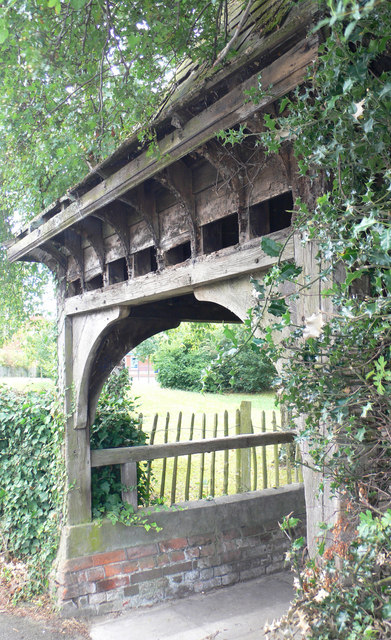
Ashford : Pump House, Kennington
This unusual building in Upper Vicarage Road, Kennington, is shown on OS Maps from the 1930's as the Pump House.
 Map © Crown Copyright")
TIP: Click the map for more Large scale mapping
- Grid Square
- TR0145, 30 images (more nearby 🔍)
- Photographer
- Chris Morley (more nearby)
- Date Taken
- Sunday, 10 August, 2008 (more nearby)
- Submitted
- Sunday, 10 August, 2008
- Subject Location
-
OSGB36:
 TR 019 451 [100m precision]
WGS84: 51:10.1740N 0:53.2418E - Camera Location
-
OSGB36: TR 019 451
- View Direction
- East-northeast (about 67 degrees)