2008
TR0145 : Ashford : Faversham Road
taken 16 years ago, near to Kennington, Kent, England
This is 1 of 2 images, with title Ashford : Faversham Road in this square
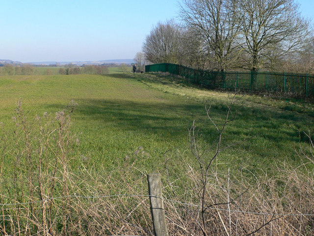
Ashford : Faversham Road
This view, looking eastwards from the junction of Faversham Road and Trinity Road, is the proposed route of a road to link the A251 and the A28. The fence on the right is the boundary of The Towers School
 Map © Crown Copyright")
TIP: Click the map for more Large scale mapping
- Grid Square
- TR0145, 30 images (more nearby 🔍)
- Photographer
- Chris Morley (more nearby)
- Date Taken
- Saturday, 16 February, 2008 (more nearby)
- Submitted
- Sunday, 10 August, 2008
- Subject Location
-
OSGB36:
 TR 016 457 [100m precision]
WGS84: 51:10.5422N 0:52.9729E - Camera Location
-
OSGB36: TR 015 457
- View Direction
- EAST (about 90 degrees)