2005
TQ4190 : Charlie Brown's
taken 18 years ago, near to Woodford Green, Redbridge, England
Charlie Brown's
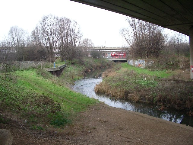
This South Woodford junction has always been known as Charlie Brown's, presumably after the landlord of a pub which stood here rather than the cartoon character. Today it's a concrete jungle of flyovers, but with the modest River Roding flowing beneath. In this view looking north, we are standing under the M11, the bus is travelling west from Ilford towards Walthamstow and the two levels of flyovers in the background carry the spur roads which link the North Circular Road with the motorway.
 Map © Crown Copyright")
TIP: Click the map for more Large scale mapping
- Grid Square
- TQ4190, 28 images (more nearby 🔍)
- Photographer
- John Davies (more nearby)
- Date Taken
- Wednesday, 21 December, 2005 (more nearby)
- Submitted
- Wednesday, 21 December, 2005
- Subject Location
-
OSGB36:
 TQ 412 902 [100m precision]
WGS84: 51:35.5776N 0:2.2200E