J3373 : Ormeau Avenue, Belfast
taken 16 years ago, near to Belfast, Co Antrim, Northern Ireland
This is 1 of 2 images, with title starting with Ormeau Avenue in this square
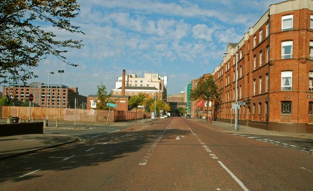
Ormeau Avenue, Belfast
Ormeau Avenue runs from the bottom of the Ormeau Road/Cromac Street to Bedford Street. Much improved (notably by the addition of a Holiday Inn), further improvement seems unlikely until a decision is taken not to proceed with the on/off/on etc inner ring road. The vacant ground (middle left, used as a car park) could then be sold for further development.
![Creative Commons Licence [Some Rights Reserved]](https://s1.geograph.org.uk/img/somerights20.gif)
|
· Find out How to reuse this image ·
Share:
|
|||||
|
There are 2 posts in a
discussion on J3373 (preview on the left) |
Suggest an update to this image | Contact the contributor | |||
Loading map... (JavaScript required)
- Grid Square
- J3373, 2776 images (more nearby
 )
)
- Photographer
- Albert Bridge (find more nearby)
- Date Taken
- Sunday, 21 September, 2008 (more nearby)
- Submitted
- Sunday, 21 September, 2008
- Category
- Street (more nearby)
- Subject Location
-
Irish:
 J 339 735 [100m precision]
WGS84: 54:35.5468N 5:55.7264W - Camera Location
-
Irish: J 340 735
- View Direction
- West-northwest (about 292 degrees)
Image classification(about):
Supplemental image
This page has been viewed about 416 times.
View this location:
KML (Google Earth) ·
Google Maps ·
Bing Maps ·
Geograph Coverage Map ·
More Links for this image
·
Bing Maps ·
Geograph Coverage Map ·
More Links for this image