J1219 : Narrow Water Tower, Warrenpoint
taken 16 years ago, near to Warrenpoint, Co Down, Northern Ireland
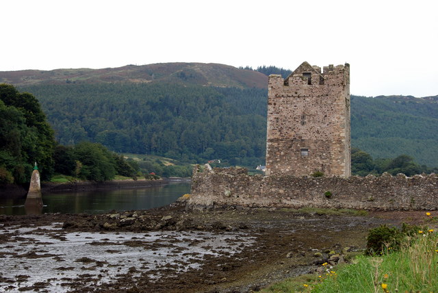
Narrow Water Tower, Warrenpoint
There has been a keep on this site since 1212. It was originally built to prevent attacks on Newry via the river by Hugh de Lacy, first Earl of Ulster, as part of the Norman fortifications built in the area. The original was destroyed in the 1641 Rebellion.
Although apparently built for military purposes during the 1560s, Narrow Water Castle is a typical example of the tower houses erected throughout Ireland from the 14th until the early 17th century.
Although apparently built for military purposes during the 1560s, Narrow Water Castle is a typical example of the tower houses erected throughout Ireland from the 14th until the early 17th century.
![Creative Commons Licence [Some Rights Reserved]](https://s1.geograph.org.uk/img/somerights20.gif)
|
· Find out How to reuse this image ·
Share:
|
|||||
| Start a discussion on J1219 | Suggest an update to this image | Contact the contributor | |||
Loading map... (JavaScript required)
- Grid Square
- J1219, 119 images (more nearby
 )
)
- Photographer
- Norman McMullan (find more nearby)
- Date Taken
- Monday, 8 September, 2008 (more nearby)
- Submitted
- Sunday, 21 September, 2008
- Category
- Castle > Castle (more nearby)
- Subject Location
-
Irish:
 J 127 192 [100m precision]
WGS84: 54:6.5916N 6:16.6445W - Camera Location
-
Irish: J 127 192
- View Direction
- West-northwest (about 292 degrees)
Image classification(about):
Geograph (Fourth Visitor for J1219)
This page has been viewed about 491 times.
View this location:
KML (Google Earth) ·
Google Maps ·
Bing Maps ·
Geograph Coverage Map ·
More Links for this image
·
Bing Maps ·
Geograph Coverage Map ·
More Links for this image