2008
NS7705 : Circular clearing in South Mains Forest
taken 16 years ago, 3 km from Ulzieside, Dumfries And Galloway, Scotland
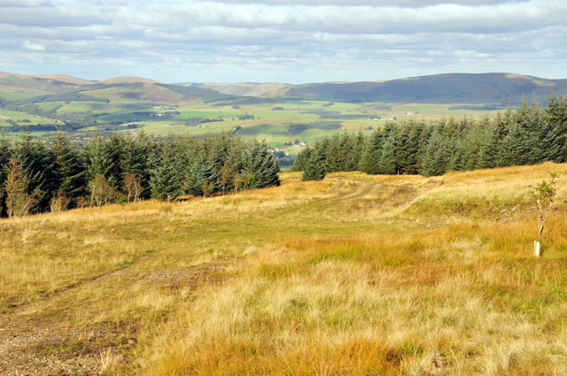
Circular clearing in South Mains Forest
On the map this is shown as the end of the track, but in fact it continues up the hill. As well as a vehicle turning circle, the clearing contains new plantings of deciduous trees.
 Map © Crown Copyright")
TIP: Click the map for more Large scale mapping
- Grid Square
- NS7705, 2 images (more nearby 🔍)
- Photographer
- Greg Morss (more nearby)
- Date Taken
- Sunday, 5 October, 2008 (more nearby)
- Submitted
- Monday, 6 October, 2008
- Subject Location
-
OSGB36:
 NS 771 059 [100m precision]
WGS84: 55:19.9045N 3:56.3337W - Camera Location
-
OSGB36: NS 770 058
- View Direction
- North-northeast (about 22 degrees)