2008
TL4847 : Duxford Chapel, hemmed in by trees and bushes
taken 16 years ago, near to Pampisford, Cambridgeshire, England
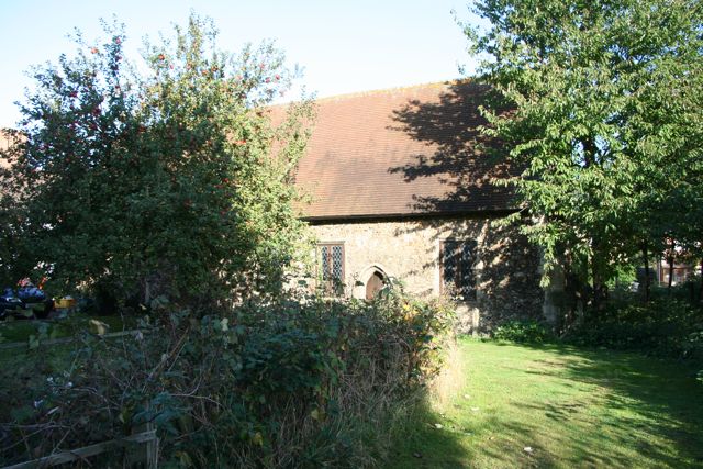
Duxford Chapel, hemmed in by trees and bushes
The chapel is all that remains of a small hospital established in the 13th century by Sir William de Colville, the local lord of the manor. The hospital was built close to a major east-west road, now by-passed. It sheltered poor travellers and tended to the sick, with a minimal staff including one or two monks. Running costs were met by the revenue from a water mill and tolls were imposed for crossing the nearby Whittlesford bridge. The chapel was largely constructed in the 14th century when it became a chantry where masses were sung for the soul of the founder. All chantries were dissolved in 1547 and Duxford chapel became a barn. IT was restored four hundred years later.
 Map © Crown Copyright")
TIP: Click the map for more Large scale mapping
- Grid Square
- TL4847, 108 images (more nearby 🔍)
- Photographer
- Duncan Grey (more nearby)
- Date Taken
- Wednesday, 8 October, 2008 (more nearby)
- Submitted
- Wednesday, 8 October, 2008
- Subject Location
-
OSGB36:
 TL 485 473 [100m precision]
WGS84: 52:6.2665N 0:10.0797E - Camera Location
-
OSGB36: TL 485 472
- View Direction
- North-northwest (about 337 degrees)