This search will mainly show images from Ireland - however some Great Britain may be included. Add the keyword "Ireland" to focus the results even more.
More: Over Time · Recent · Map · Browser · Others
Images of:

J5048 : Ringmore Wood near Downpatrick by Albert Bridge
J5045 : Saul Road, Downpatrick by Dean Molyneaux
J5344 : Cropland at Ballyalton House Farm by Eric Jones
J5048 : Drumlin near Downpatrick (3) by Albert Bridge
SO7509 : Stroudwater Canal, Saul Junction by Chris Allen
J5146 : The village of Saul by Eric Jones
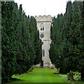
SO7409 : Tower of St. James' church, Saul by Jonathan Billinger
SO7509 : Gloucester and Sharpness Canal by Philip Halling
J5246 : St Patrick's, Saul viewed from the church car park by Eric Jones
J5344 : Farmland above the Ballyculter Road by Eric Jones
SO7509 : Stable Cafe by Oliver Dixon
J5246 : Statue of St Patrick near Saul by Albert Bridge
J5147 : The Ballintogher Road near Saul (2) by Albert Bridge
J5048 : Fields and trees near Downpatrick (4) by Albert Bridge
J5144 : The junction of the Ballyhornan and Struell Wells Roads by Eric Jones
J5144 : The Struell Wells near Saul (3) by Albert Bridge
SO7509 : Swing bridge at Saul Junction, Gloucester & Sharpness Ship Canal by P L Chadwick
J5246 : Saul Co. Down by Shane Killen
J5146 : Postbox BT30 64, Saul (July 2017) by Albert Bridge
J5146 : St Patrick's parish church, Saul (1) by Albert Bridge
J4946 : Autumn, Quoile Pondage near Downpatrick by Albert Bridge
J5147 : The Lisboy Road near Downpatrick by Albert Bridge
J5048 : Power lines near Downpatrick by Albert Bridge
J4946 : The Mearne Road near Downpatrick by Albert Bridge
J5344 : Wooded site of the Ballyalton Court Tomb viewed from the Ballyculter Road by Eric Jones
J5144 : Former stables on the Ballyhornan Road by Eric Jones
SO7409 : Road to Fretherne by Sarah Charlesworth
SO7509 : Spring Rhyne by Philip Halling
J5048 : Trees and drystone wall near Downpatrick (2) by Albert Bridge
J5144 : Struell Wells by N Chadwick
J5345 : View north along the Lough Money anglers' track by Eric Jones
J4946 : Picnic site near Downpatrick by Albert Bridge
J5046 : St Patrick's Memorial Church, Saul by N Chadwick
J5345 : The wooded slopes of Slievenagriddle viewed from the Ballyculter Road by Eric Jones
J5144 : The ruined chapel at Struell from the Drinking Well by Eric Jones
J5144 : The Slievegrane Road by Eric Jones
J5048 : The Quoile Pondage near Downpatrick (2) by Albert Bridge
J5344 : View north-eastwards along Ballyculter Road by Eric Jones
J5145 : Arching trees on the Slievegrane Road by Eric Jones
J4946 : Flooding, Quoile Pondage (2) by Albert Bridge
J5146 : The junction of Mearne Road and St Patrick's Road at Saul by Eric Jones
SO7509 : Saul Junction by Philip Halling
J5144 : The nave and west doorway of the ruined church at Struell Wells by Eric Jones
J5047 : The Strangford Road west of the Saul Mills Road junction by Eric Jones
J5345 : Lough Money near Downpatrick (3) by Albert Bridge
SO7409 : Passage Road, Saul by Jaggery
J5246 : The Priests' Plot at Saul Catholic Church by Eric Jones
J5244 : Hill farmland east of Ballyalton by Eric Jones
J5047 : The Quoile in flood (4) by Albert Bridge
J5146 : Mearne Road in the village of Saul by Eric Jones
SO7409 : Gardeners Pool, Saul by Jaggery
J5246 : Statue of St Patrick near Saul (2) by Albert Bridge
SO7509 : Gloucester and Sharpness Canal, Saul by David Griffiths
SO7509 : Saul Junction on the Gloucester and Sharpness Canal by Vincent Jones


showing 54 of About 452 results. Explore these images more: in the Browser or in the standard search (may return slightly different results).
· Too many imprecise results? Try Pure Keyword Match for 'Saul'
You are not logged in login | register
showing 54 of About 452 results. Explore these images more: in the Browser or in the standard search (may return slightly different results).