River Waveney :: Shared Description
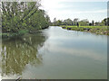
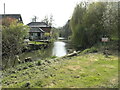
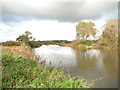
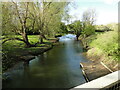
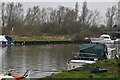
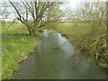
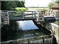
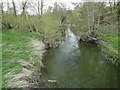
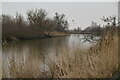
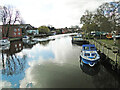
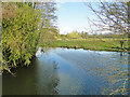
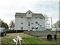
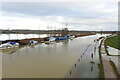
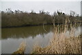
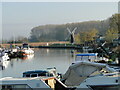
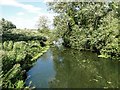
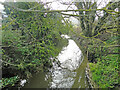
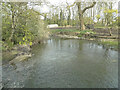
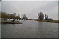
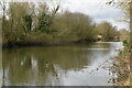
The River Waveney forms the boundary between Suffolk and Norfolk. It rises at Redgrave Fen and flows in an easterly direction though the towns of Diss, Bungay (the head of navigation) and Beccles. There is a weir at Billingford, shortly after the River Dove, flowing northwards from Eye, joins the Waveney on the southern bank. The Waveney passes round Bungay and on to Beccles. Having skirted past Oulton Broad it passes through Somerleyton and Hadiscoe before merging with the Yare in Breydon Water.
by Adrian S Pye
Related descriptions
- Norfolk Rivers
By Adrian S Pye. Used on 188 images
- Bungay Castle
By Ashley Dace. Used on 18 images
- Carlton and Oulton Marshes
By Roger Jones. Used on 8 images
- Beccles Station
By N Chadwick. Used on 18 images
- River Leven (West Dunbartonshire)
By Lairich Rig. Used on 212 images
- River Yare
By Adrian S Pye. Used on 7 images
- Oulton Broad to Lowestoft South Docks railway line
By Adrian S Pye. Used on 45 images
- View all images using this description in the Browser | On a Map
- View all images using "River Waveney" Shared Description(s) | (Just this shared description)
- Find images mentioning the words [ River Waveney ] | (in the Browser)
These Shared Descriptions are common to multiple images. For example, you can create a generic description for an object shown in a photo, and reuse the description on all photos of the object. All descriptions are public and shared between contributors, i.e. you can reuse a description created by others, just as they can use yours.
Created: Mon, 5 Apr 2021, Updated: Wed, 7 Apr 2021
The 'Shared Description' text on this page is Copyright 2021 Adrian S Pye, however it is specifically licensed so that contributors can reuse it on their own images without restriction.