Showing most recent first, in descending order
images in cluster Centre in H4473
Image clustering - assigning images labels - is an automated process, based on the image title/description. It's not totally accurate, and can sometimes assign images to odd clusters
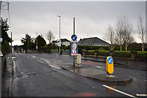
in H4473, near An Oghmagh, taken Wednesday, 4 December, 2019, by Kenneth Allen
Explore these images in the Browser or Explore matching images including in surrounding squares (if any!)
All images  © Kenneth Allen and licensed for reuse under this Creative Commons Licence
Other Automatic clusters in H4473
- River Strule
- St Lucia Barracks
- Gortmore Park
- Located along the Derry Road
- Hunter Crescent
- Lisanelly Camp
- Riverside Path
- Army Buildings
- Old Military Vehicles
- Straughroy
- Strathroy
- Gortmore Drive
- B48 Derry Road
- New Pathway
- Avenue Retail Park
- Gortmore Gardens
- Bailey Bridge
- Heading South-east towards the Town
- Officer's Mess
- Sculpture
- St Lucia and Waterloo Blocks
- Looking North-west
- Ferris
- Parade Ground
- Harmony Heights
- Strathroy Housing Estate
- Memorial Tablet
- Tarmac
- Terraced Houses
- Today
- Access to Gortmore
- Sewage Treatment
- School
- Map
- Information Board
- Health Centre
- Gas Pipeline Contract
- Flood Wall
- Ashgrove Park
- Vivo