Showing most recent first, in descending order
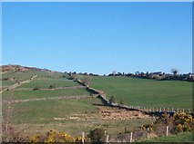
images in cluster Fields in J3235
Image clustering - assigning images labels - is an automated process, based on the image title/description. It's not totally accurate, and can sometimes assign images to odd clusters
in J3235, near Castlewellan, taken Tuesday, 30 April, 2013, by Eric Jones
Explore these images in the Browser or Explore matching images including in surrounding squares (if any!)
All images  © Eric Jones and licensed for reuse under this Creative Commons Licence
Other Automatic clusters in J3235
- A25 Dublin Road
- Junction with the A25
- Carrownfreagh Farm
- Burrenreagh Road at its Junction
- Burrenbridge Road
- Altnadua Road
- Burren Bridge
- Land
- Buildings
- Ballymagreehan Wood
- Farmstead
- North
- Slopes
- Castlewellan Forest Park
- Lane
- Farmhouse
- O'Hares
- Slopes of Ballymagreehan Hill
- New Bungalow
- Filling Station
- Farmland
- Descending
- Castlewellan Castle Demesne
- South side of the A25