Public Tags
Tag: Crossroads
Other tags: former:Crossroads
looking towards the:Crossroads
Showing latest 50 of 5,194 images tagged with Crossroads tag.
|
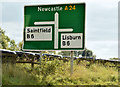
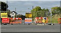
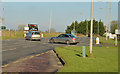
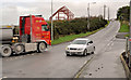
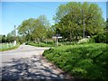
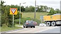
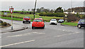
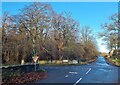
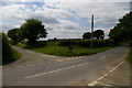
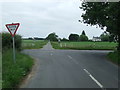
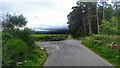
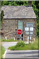
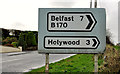
Direction sign, The Temple Crossroads (October 2015)
by Albert Bridge for square J3560 Direction sign approaching the crossroads from the Carryduff/Belfast direction.
|
|
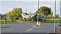
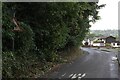
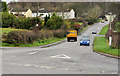
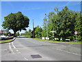
The Temple Crossroads - October 2015(1)
by Albert Bridge geograph for square J3560 The present staggered crossroads seen from the Saintfield side.
Tags:
subject:CrossroadX
Crossroads
RoadX
Road JunctionX
top:Roads, Road TransportX
Temple Crossroads (Co Down)X
|
|
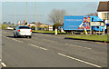
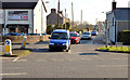
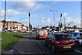
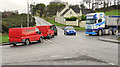
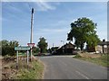
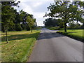
The Temple Crossroads (2013-6)
by Albert Bridge geograph for square J3560 The view towards the main road from the Lisburn side. I spent about 15 minutes... (more)
|
|
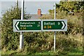
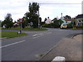
Direction signs, The Temple Crossroads - October 2015(2)
by Albert Bridge for square J3560 Direction signs opposite the road from Lisburn.
|
|
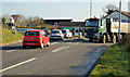
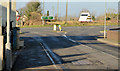
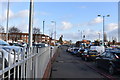
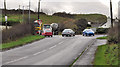
The Temple Crossroads - October 2015(2)
by Albert Bridge geograph for square J3560 The road to Lisburn temporarily closed for water main works.
|
|
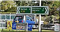
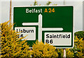
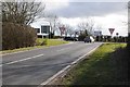
Direction signs, The Temple Crossroads - October 2015(1)
by Albert Bridge for square J3560 Direction signs opposite the road from Saintfield. J3560 : New roundabout, Temple crossroads - December 2016(1) shows the... (more)
|
|
The Temple Crossroads (2013-7)
by Albert Bridge geograph for square J3560 The right-turn bay for northbound traffic heading towards Saintfield. The blue... (more)
|
|
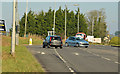
The Temple Crossroads (2013-5)
by Albert Bridge geograph for square J3560 The western side of the main road, looking towards Carryduff, as a car, from the... (more)
|
|
The Temple Crossroads (2013-4)
by Albert Bridge geograph for square J3560 The eastern side of the main road, looking towards Carryduff, as two cars cross... (more)
|

|
The Temple Crossroads (2013-3)
by Albert Bridge geograph for square J3560 The eastern side of the main road looking towards Carryduff. The road to... (more)
|
|
The Temple Crossroads (2013-2)
by Albert Bridge geograph for square J3560 The view, towards Saintfield, from the main road. All the vehicles turned right... (more)
|
|
The Temple Crossroads (2013-1)
by Albert Bridge geograph for square J3560 The view, from the Saintfield side, towards the main road. The road to Lisburn... (more)
|
|
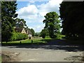
The Temple crossroads sign near Carryduff
by Albert Bridge for square J3560 Category: Road signs The trees have grown since this one J3560 : Signboard at The Temple taken in October 2005.... (more)
|
|
Craigantlet crossroads (3)
by Albert Bridge geograph for square J4376 Craigantlet crossroads looking towards Bangor. Whinney Hill J4376 : Whinney Hill, Craigantlet (1) (from... (more)
|
|
Crossroads Sign, Gilwern
by Luke Jones geograph for square SO2415 Old Crossroads sign for incoming crossroad between Cae Meldon, Kennelwood and... (more)
Tags:
near:AbergavennyX
subject:CrossroadX
Crossroads SignX
type:GeographX
place:GilwernX
Old SignX
top:Roads, Road TransportX
subject:SignX
top:Village, Rural SettlementX
|
|
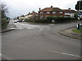
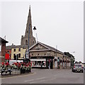
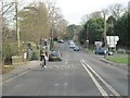
Scott Arms crossroads 2 - Great Barr, Sandwell, West Midlands
by Martin Richard Phelan geograph for square SP0494 This photo of the Scott Arms crossroads was taken looking east on the A4041... (more)
Tags:
A34 Birmingham RoadX
A4041 Newton RoadX
A4041 Queslett RoadX
A452 Chester RoadX
place:BirminghamX
top:Business, Retail, ServicesX
subject:CrossroadX
type:GeographX
top:LowlandsX
top:PathsX
top:Roads, Road TransportX
place:Scott Arms CrossroadsX
place:Scott Arms Shopping CentreX
top:Suburb, Urban FringeX
place:Sutton ParkX
area:West MidlandsX
|
|
Scott Arms crossroads 1 - Great Barr, Sandwell, West Midlands
by Martin Richard Phelan geograph for square SP0494 This photo of the Scott Arms crossroads was taken looking east on the A4041... (more)
Tags:
A34 Birmingham RoadX
A4041 Newton RoadX
A4041 Queslett RoadX
A452 Chester RoadX
place:BirminghamX
top:Business, Retail, ServicesX
subject:CrossroadX
type:GeographX
top:LowlandsX
top:PathsX
top:Roads, Road TransportX
place:Scott Arms CrossroadsX
place:Scott Arms Shopping CentreX
top:Suburb, Urban FringeX
place:Sutton ParkX
area:West MidlandsX
|
|
Crossroads at the 276 metre spot height
by Christine Johnstone geograph for square SK0449 Shaw-wall Lane meeting Park Lane, at the road from Froghall and Foxt to Winkhill.
Tags:
Crossroads
looking towards the:Crossroads
LaneX
Lane CrossroadX
Minor CrossroadsX
Minor RoadX
Road SignpostX
top:Roads, Road TransportX
Rural CrossroadsX
Rural LaneX
Rural RoadX
SignpostX
Spot HeightX
|
|
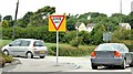
Awkward crossroads
by Mr Ignavy geograph for square SU6353 Category: Crossroads View from Darlington Road of the crossroads with the Sherborne Road. The road... (more)
Tags:
subject:CrossroadX
top:Roads, Road TransportX
|
|
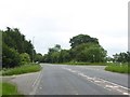
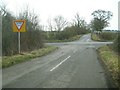
Staggered crossroads with A37 at Old Down
by David Smith geograph for square ST6251 The staggered crossroads is the result of a major realignment of the roads.... (more)
|
|
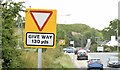
"Give way" signs, Craigantlet - July 2015 (3)
by Albert Bridge geograph for square J4376 Pending a decision about the reconstruction of Craigantlet crossroads there have... (more)
|
|
"Give way" signs, Craigantlet - July 2015 (2)
by Albert Bridge geograph for square J4376 Pending a decision about the reconstruction of Craigantlet crossroads there have... (more)
|
|
"Give way" signs, Craigantlet - July 2015 (1)
by Albert Bridge geograph for square J4376 Pending a decision about the reconstruction of Craigantlet crossroads there have... (more)
|
|
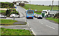
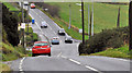
Rothersthorpe: Banbury Lane Crossroads
by Nigel Cox geograph for square SP7056 The crossroads really is the only noteworthy feature of this otherwise... (more)
|
|
Craigantlet crossroads (6)
by Albert Bridge geograph for square J4376 Craigantlet crossroads from the Bangor (Craigantlet Road) J4376 : The Craigantlet Road, Craigantlet (1) side. The... (more)
|
|
Craigantlet crossroads (5)
by Albert Bridge geograph for square J4376 Craigantlet crossroads, from the Newtownards side, looking towards Whinney Hill... (more)
|
|
Craigantlet crossroads (4)
by Albert Bridge geograph for square J4376 Craigantlet crossroads, from the Newtownards side, looking towards Whinney Hill... (more)
|
|
Craigantlet crossroads (2)
by Albert Bridge geograph for square J4376 Craigantlet crossroads from the corner of Whinney Hill J4376 : Whinney Hill, Craigantlet (1) (Belfast and... (more)
|
|
Craigantlet crossroads (1)
by Albert Bridge geograph for square J4376 Craigantlet crossroads from Whinney Hill J4376 : Whinney Hill, Craigantlet (1) (Belfast and Holywood).... (more)
|
|
Bywell crossroads
by Oliver Dixon for square NZ0462 An unusual configuration for a crossroads. The main B6309 comes in from the... (more)
Tags:
type:Cross GridX
subject:CrossroadX
Crossroads
top:Roads, Road TransportX
WoodlandX
top:Woodland, ForestX
|
|
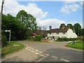
House in the countryside near Bordon
by Malc McDonald geograph for square SU8237 A house at a crossroads at Saunders Green, in the Hampshire countryside.
Tags:
near:BordonX
subject:CrossroadX
Crossroads
type:GeographX
county:HampshireX
near:HeadleyX
near:Headley (Hampshire)X
near:Headley DownX
top:Housing, DwellingsX
Junction of Rural RoadsX
road:Minor RoadX
Minor Road JunctionX
Minor Rural CrossroadsX
Minor Rural RoadX
Minor Rural Road JunctionX
Road JunctionX
top:Roads, Road TransportX
Rural CrossroadsX
Rural HouseX
Rural RoadX
Rural Road JunctionX
top:Village, Rural SettlementX
|
|
Village crossroads, Craghead
by Robert Graham geograph for square NZ2150 The ex mining village of Craghead was created around this crossroad, mainly in... (more)
Tags:
subject:CrossroadX
Ex-Mining VillageX
type:GeographX
top:Roads, Road TransportX
Village CrossroadsX
top:Village, Rural SettlementX
|
|
Approaching the crossroads, Bickerton church
by Christopher Hilton for square SJ5153 The Sandstone Trail runs across this crossroads and up the lane opposite.
Tags:
type:Cross GridX
subject:CrossroadX
CrossroadX
Crossroads
LaneX
LanesX
top:Roads, Road TransportX
long distance path:Sandstone TrailX
Sandstone TrailX
Stop SignX
The Sandstone TrailX
|
|
Duckington: crossroads on Coach Road
by Christopher Hilton geograph for square SJ4951 Tags:
CrossroadX
Crossroads
type:GeographX
subject:LaneX
LaneX
Lane CrossroadX
top:Roads, Road TransportX
Rural CrossroadsX
|
|
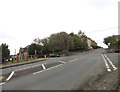
B5152 crossroads at Kingsley
by Jeff Buck geograph for square SJ5374 Looking north at the crossroads with Kingsley Road (B5152), Norley Road, Middle... (more)
|
|
Crossroads at Skelbrooke
by Christine Johnstone geograph for square SE5011 Straight Lane straight on, Bannister Lane to the left, Doncaster Lane to the... (more)
|
|
Mill Road at Friston Crossroads
by Geographer geograph for square TM4160 Category: Crossroads At the junction with the B1121 Saxmundham/Aldeburgh Road
Tags:
Aldeburgh RoadX
B1121X
B1121 Aldeburgh RoadX
B1121 Saxmundham RoadX
Crossroads
at:FristonX
Friston CrossroadsX
at:Friston CrossroadsX
Road JunctionX
top:Roads, Road TransportX
at the junction with:The B1121 Aldeburgh RoadX
at the junction with:The B1121 Saxmundham RoadX
|
|
Halesworth Road Crossroads
by Geographer geograph for square TM3671 Category: Crossroads The crossroads of the Halesworth Road, Sibton Green & Dunwich Lane.
Looking... (more)
Tags:
C Road (Classified C)X
Crossroads
Dunwich LaneX
Halesworth Road CrossroadsX
subject:Road JunctionX
top:Roads, Road TransportX
at:SibtonX
looking towards:SibtonX
Sibton GreenX
|
|
Crossroads
by Keith Evans geograph for square TM0888 Crossroad of the Haugh Road (B1077) Heath Road and Long Lane near to New... (more)
|
|
Crossroads on the A422
by Philip Halling geograph for square SP2748 Crossroads on the A422, to the east of Ettington, at the junction with the Fosse... (more)
|
|
Crossroads on the B4026
by Philip Halling geograph for square SP3229 Crossroads on the B4026 near Over Norton.
|
|
Crossroads near Wester Urchany
by Mick Garratt geograph for square NH8748 |
|
The Crossroads at the Centre of Holbeach
by Tony Atkin geograph for square TF3524 Even though most traffic now takes the bypass, this crossroads is still very... (more)
|
|
Ballinastoe Crossroads, Co. Wicklow
by P L Chadwick geograph for square O2007 This crossroads is marked on maps as Ballinastoe Crossroads. Going from left to... (more)
|
|
Crossroads at Wilton
by Mike Smith geograph for square SU0931 These crossroads are right at the heart of the village. The roads from the... (more)
|
|
Grange Mill Crossroads
by Mick Garratt geograph for square SK2457 Tags:
looking towards the:Crossroads
Crossroads
top:Roads, Road TransportX
approaching:The CrossroadsX
|
|
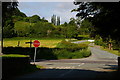
Crossroad at Clifton Hampden
by Bill Nicholls geograph for square SU5495 More of a staggered crossroad which has always been a bit of a bottleneck due to... (more)
|
|
Crossroads, Culcavy
by Albert Bridge geograph for square J2360 A crossroads at the northern end of Culcavy. The Culcavy Road... (more)
|
|
The Craigantlet Road, Craigantlet (2)
by Albert Bridge for square J4376 The view down the Craigantlet Road J4376 : The Craigantlet Road, Craigantlet (1) (from Bangor) towards Craigantlet... (more)
|
|
Direction signs, Craigantlet crossroads
by Albert Bridge for square J4376 Direction signs at Whinney Hill J4376 : Whinney Hill, Craigantlet (1). The Dunlady Road (to Dundonald) is... (more)
|