Public Tags
Tag: Forest·Path
Other tags: category:Forest Path
Showing latest 50 of 497 images tagged with Forest Path tag.
|
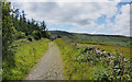
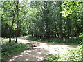
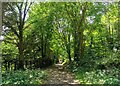
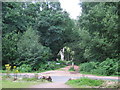
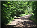
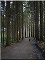
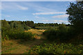
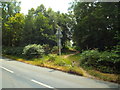
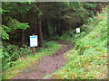
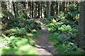
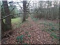
Path, Drumkeeragh Forest
by Rossographer geograph for square J3246 Path on the north-western edge of Drumkeeragh Forest with fields on the other... (more)
Tags:
place:Drumkeeragh ForestX
subject:ForestX
Forest Path
type:GeographX
PathX
top:UplandsX
Woodland PathX
top:Woodland, ForestX
|
|
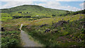
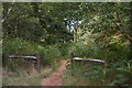
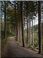
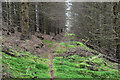
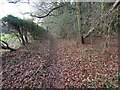
Path, Drumkeeragh Forest
by Rossographer geograph for square J3346 Path through cleared trees at Drumkeeragh Forest; the northern side of Slieve... (more)
Tags:
Cleared ForestX
place:Drumkeeragh ForestX
subject:ForestX
Forest Path
type:GeographX
PathX
top:UplandsX
Woodland PathX
top:Woodland, ForestX
|
|
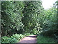
Path in Epping Forest
by Malc McDonald geograph for square TQ4299 The post marks where the path meets Woodridden Hill, a busy "A" road... (more)
Tags:
Ancient WoodlandX
place:Epping ForestX
place:EssexX
Forest Path
PathX
top:PathsX
Woodland PathX
top:Woodland, ForestX
|
|
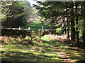
Accessible path, Epping Forest
by Malc McDonald geograph for square TQ4198 This path in Epping Forest has been designed to be accessible to people using... (more)
Tags:
Ancient WoodlandX
place:Epping ForestX
place:EssexX
Forest Path
PathX
top:PathsX
Wheelchair AccessX
Woodland PathX
top:Woodland, ForestX
|
|
Paths in Epping Forest
by Malc McDonald geograph for square TQ4198 A path junction in Epping Forest.
Epping Forest is an ancient woodland and... (more)
Tags:
Ancient WoodlandX
place:Epping ForestX
place:EssexX
Forest Path
PathX
top:PathsX
Woodland PathX
top:Woodland, ForestX
|
|
Path in Epping Forest
by Malc McDonald geograph for square TQ4297 At the wooden fence, the path crosses a brook.
Epping Forest is an ancient... (more)
Tags:
Ancient WoodlandX
place:Epping ForestX
place:EssexX
Forest Path
PathX
top:PathsX
Woodland PathX
top:Woodland, ForestX
|
|
Path in Epping Forest
by Malc McDonald geograph for square TQ4297 A path in Epping Forest.
Epping Forest is an ancient woodland and former... (more)
Tags:
Ancient WoodlandX
place:Epping ForestX
place:EssexX
Forest Path
PathX
top:PathsX
Woodland PathX
top:Woodland, ForestX
|
|
Path through Epping Forest
by Malc McDonald geograph for square TQ4197 A path in Epping Forest. The land here slopes down to a brook, which the path... (more)
Tags:
Ancient WoodlandX
place:Epping ForestX
place:EssexX
Forest Path
PathX
top:PathsX
Woodland PathX
top:Woodland, ForestX
|
|
Path in Friston Forest, Near Jevington
by PAUL FARMER geograph for square TQ5500 |
|
Suffolk Coast Path in Tunstall Forest
by Christopher Hilton geograph for square TM3953 Tags:
ForestX
Forest Path
type:GeographX
subject:PathX
PathX
top:PathsX
Suffolk Coast FootpathX
Suffolk Coast PathX
on:Suffolk Coast PathX
long distance path:Suffolk Coast PathX
Tunstall ForestX
top:Woodland, ForestX
|
|
Path in Epping Forest
by Malc McDonald geograph for square TQ4199 Epping Forest is an ancient woodland and former Royal hunting forest which... (more)
Tags:
Ancient WoodlandX
place:Epping ForestX
place:EssexX
Forest Path
PathX
top:PathsX
Woodland PathX
top:Woodland, ForestX
|
|
Path in Epping Forest
by Malc McDonald geograph for square TQ4198 Epping Forest is an ancient woodland and former Royal hunting forest which... (more)
Tags:
Ancient WoodlandX
place:Epping ForestX
place:EssexX
Forest Path
PathX
top:PathsX
Woodland PathX
top:Woodland, ForestX
|
|
Path in Epping Forest
by Malc McDonald geograph for square TQ4198 Epping Forest is an ancient woodland and former Royal hunting forest which... (more)
Tags:
Ancient WoodlandX
place:Epping ForestX
place:EssexX
Forest Path
PathX
top:PathsX
Woodland PathX
top:Woodland, ForestX
|
|
Path in Epping Forest
by Malc McDonald geograph for square TQ4198 Epping Forest is an ancient woodland and former Royal hunting forest which... (more)
Tags:
Ancient WoodlandX
place:Epping ForestX
place:EssexX
Forest Path
PathX
top:PathsX
Woodland PathX
top:Woodland, ForestX
|
|
Path in Epping Forest
by Malc McDonald geograph for square TQ4297 Epping Forest is an ancient woodland and former Royal hunting forest which... (more)
Tags:
Ancient WoodlandX
place:Epping ForestX
place:EssexX
Forest Path
PathX
top:PathsX
Woodland PathX
top:Woodland, ForestX
|
|
Path in Epping Forest
by Malc McDonald geograph for square TQ4298 Epping Forest is an ancient woodland and former Royal hunting forest which... (more)
Tags:
Ancient WoodlandX
place:Epping ForestX
place:EssexX
Forest Path
PathX
top:PathsX
Woodland PathX
top:Woodland, ForestX
|
|
Path in Epping Forest
by Malc McDonald geograph for square TQ4298 Epping Forest is an ancient woodland and former Royal hunting forest which... (more)
Tags:
Ancient WoodlandX
place:Epping ForestX
Forest Path
PathX
top:PathsX
Woodland PathX
top:Woodland, ForestX
|
|
Path in Epping Forest
by Malc McDonald geograph for square TQ4297 Epping Forest is an ancient woodland and former Royal hunting forest which... (more)
Tags:
Ancient WoodlandX
place:Epping ForestX
place:EssexX
Forest Path
PathX
top:PathsX
Woodland PathX
top:Woodland, ForestX
|
|
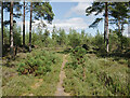
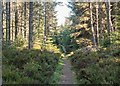
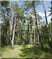
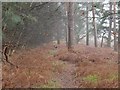
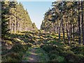
Path, Culbin Forest
by Craig Wallace geograph for square NH9659 A path through a wide forest ride, heading towards a junction with a forest track.
Tags:
forest:Culbin ForestX
Forest Path
type:GeographX
woodland:MixedX
top:PathsX
tree:Scots PineX
top:Woodland, ForestX
|
|
Path in Friston Forest
by PAUL FARMER geograph for square TV5599 |
|
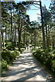
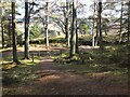
Path, Tollymore
by Rossographer geograph for square J3432 One of the many paths through Tollymore Forest Park.
Tags:
subject:ForestX
Forest Path
type:GeographX
PathX
top:PathsX
TollymoreX
place:TollymoreX
place:Tollymore ForestX
place:Tollymore Forest ParkX
TreesX
Woodland PathX
top:Woodland, ForestX
|
|
Path, Tollymore
by Rossographer geograph for square J3332 One of the many paths through Tollymore Forest Park.
Tags:
subject:ForestX
Forest Path
type:GeographX
PathX
top:PathsX
place:TollymoreX
TollymoreX
place:Tollymore ForestX
place:Tollymore Forest ParkX
TreesX
Woodland PathX
top:Woodland, ForestX
|
|
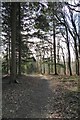
Forest path
by David Pashley geograph for square TL8192 Forest path alongside Big Wood, off forest road 37.
Tags:
Breckland NorfolkX
top:Flat LandscapesX
Forest Path
type:GeographX
subject:PathX
top:PathsX
Thetford ForestX
top:Woodland, ForestX
|
|
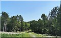
Grassy path off forest road
by David Pashley geograph for square TL8097 Grassy path off forest road 161.
Tags:
subject:ForestX
Forest Path
type:GeographX
Grassy PathX
top:LowlandsX
top:PathsX
Thetford ForestX
top:Woodland, ForestX
|
|
Tunstall Forest, off the Suffolk Coast Path
by Christopher Hilton geograph for square TM3952 Tags:
ForestX
Forest Path
type:GeographX
PathX
Suffolk Coast FootpathX
on:Suffolk Coast PathX
Suffolk Coast PathX
long distance path:Suffolk Coast PathX
Tunstall ForestX
top:Woodland, ForestX
|
|
Footpath junction, Hargate Forest
by Christine Johnstone geograph for square TQ5737 Hargate Forest is open access woodland, managed by the Woodland Trust. It is a... (more)
Tags:
AONBX
path:FootpathX
Forest Path
type:GeographX
HargateX
High WealdX
Open Access WoodlandX
subject:PathX
top:PathsX
Woodland PathX
Woodland Trust PropertyX
top:Woodland, ForestX
|
|
Wide path, Hargate Forest
by Christine Johnstone geograph for square TQ5736 Hargate Forest is open access woodland, managed by the Woodland Trust. It is a... (more)
Tags:
AONBX
path:FootpathX
Forest Path
type:GeographX
HargateX
High WealdX
Open Access WoodlandX
subject:PathX
top:PathsX
Woodland PathX
Woodland Trust PropertyX
top:Woodland, ForestX
|
|
Footpath in Hargate Forest
by Christine Johnstone geograph for square TQ5736 Hargate Forest is open access woodland, managed by the Woodland Trust. It is a... (more)
Tags:
AONBX
path:FootpathX
Forest Path
type:GeographX
HargateX
High WealdX
Open Access WoodlandX
subject:PathX
top:PathsX
Woodland PathX
Woodland Trust PropertyX
top:Woodland, ForestX
|
|
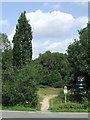
Footpath in Ashdown Forest
by Malc McDonald geograph for square TQ4428 A footpath leading into Ashdown Forest.
|
|
Path in Inverernie Forest
by valenta geograph for square NH6838 Once a forestry road, now encroached upon by the forest to become a path, still... (more)
Tags:
subject:ForestX
Forest Path
type:GeographX
forest:Inverernie ForestX
near:InvernessX
top:PathsX
top:Sport, LeisureX
top:UplandsX
top:Woodland, ForestX
|
|
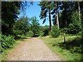
Delamere Forest
by Jeff Buck geograph for square SJ5470 One of the many smaller, obscure trails in Delamere Forest. Delamere, which... (more)
Tags:
county:CheshireX
place:Delamere ForestX
country:EnglandX
ForestX
subject:ForestX
Forest Path
Forest TrailX
Forestry CommissionX
Forestry Commission LandX
PathX
top:PathsX
top:Woodland, ForestX
|
|
Path near High Beach, Epping Forest
by Malc McDonald geograph for square TQ4198 Epping Forest is an ancient woodland and former Royal hunting forest which... (more)
Tags:
Ancient WoodlandX
place:Epping ForestX
place:EssexX
Forest Path
place:High BeachX
top:PathsX
Woodland PathX
top:Woodland, ForestX
|
|
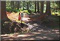
Diversion around Buzzard's Nest, Glentress
by Jim Barton geograph for square NT2841 A path, steep in places, between contouring forest roads. The diversion is part... (more)
|
|
Path to forest gate, Black Rig
by Jim Barton geograph for square NT3531 The last part of the forest path from Scarf Rig to the hillside above Glengaber.
Tags:
Coniferous PlantationX
Elibank & Traquair ForestX
Forest Path
type:GeographX
top:PathsX
top:Woodland, ForestX
|
|
Ballycastle Forest
by Rossographer geograph for square D1337 Path through Ballycastle Forest, close to the small car park on the Drumavoley Road.
Tags:
Ballycastle ForestX
ForestX
subject:ForestX
Forest Path
Forest RoadX
Forest TrackX
type:GeographX
top:PathsX
top:UplandsX
top:Woodland, ForestX
|
|
Link path to Soonhope, Glentress Forest
by Jim Barton geograph for square NT2741 The gate is at the boundary of the Forestry & Land Glentress Forest and is... (more)
Tags:
Forest Path
type:GeographX
Glentress ForestX
top:PathsX
Pedestrian GateX
top:Woodland, ForestX
|
|
Forest path
by Philip Halling geograph for square SO6016 Forest path near Joy's Green in Upper Lydbrook.
|
|
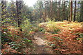
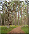
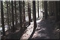
Path, Culbin Forest
by Craig Wallace geograph for square NH9559 A narrow path along a forest ride, passing by tall Scots pine trees.
Tags:
forest:Culbin ForestX
Forest Path
type:GeographX
woodland:MixedX
top:PathsX
tree:Scots PineX
top:Woodland, ForestX
|
|
Path, Culbin Forest
by Craig Wallace geograph for square NH9459 A path through the forest, close to Cran Loch. Passing by some tall Scots pine trees.
Tags:
forest:Culbin ForestX
Forest Path
type:GeographX
top:PathsX
tree:Scots PineX
top:Woodland, ForestX
|
|
Sunny Caledonian forest
by Andy Waddington geograph for square NH9007 Category: Forest path Just one of an extensive network of paths used by both walkers and cyclists on... (more)
|
|
Forest path near Elibank Castle
by Jim Barton geograph for square NT3936 The path descends to meet a forest track west of the castle.
|
|
Pikes Knowe trail, Cardrona Forest
by Jim Barton geograph for square NT3037 The path joins a forest road not far from Cardrona Tower.
Tags:
Cardrona ForestX
Forest Path
type:GeographX
top:PathsX
Track and Path JunctionX
top:Woodland, ForestX
|
|
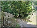
Road in Friston Forest with Footpath Crossing
by PAUL FARMER geograph for square TV5598 Tags:
Flint WallX
Flint WallsX
FootpathX
subject:ForestX
Forest Path
place:Friston ForestX
type:GeographX
PathX
subject:PathX
top:PathsX
subject:RoadX
top:Roads, Road TransportX
TreesX
top:Woodland, ForestX
WoodsX
|
|
Path and track junction, Cardona Forest
by Jim Barton geograph for square NT2937 The path (both yellow and brown markers) meets a forest track on the east side... (more)
|
|
Forest path
by David Pashley geograph for square TL9392 Forest path with dry ditch on the left.
Tags:
Dry DitchX
top:Flat LandscapesX
Forest Path
type:GeographX
subject:PathX
top:PathsX
Thetford ForestX
top:Woodland, ForestX
|
|
Path along edge of forest
by David Pashley geograph for square TL9392 Well worn path as it is near caravan site.
Tags:
top:Farm, Fishery, Market GardeningX
top:Flat LandscapesX
Forest EdgeX
Forest Path
type:GeographX
subject:PathX
top:PathsX
Thetford ForestX
top:Woodland, ForestX
|
|
Forest path
by David Pashley geograph for square TL8097 Forest path round the edge of Quadrilateral Covert
Tags:
top:Farm, Fishery, Market GardeningX
top:Flat LandscapesX
Forest Path
type:GeographX
subject:PathX
top:PathsX
Thetford ForestX
top:Woodland, ForestX
|
|
New path, Cardrona Forest (2)
by Jim Barton geograph for square NT2938 Where the new path on Cardrona Hill crosses the forest road. According to the... (more)
|
|
Forest path Inverernie Forest
by valenta geograph for square NH6838 Looking south-east, this path is just outside the forest boundary as defined by... (more)
|
|
Forest path Inverernie Forest
by valenta geograph for square NH6838 Looking north-west, this path is just outside the forest boundary as defined by... (more)
|