Public Tags
Tag: Reclaimed·Land
Showing latest 50 of 274 images tagged with Reclaimed Land tag.
|
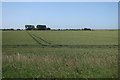
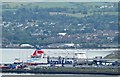
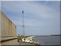
Reclaimed land, Belfast Harbour estate (October 2016)
by Albert Bridge geograph for square J3777 Much of the eastern side of the harbour estate (including the City Airport) is... (more)
Tags:
place:BelfastX
Belfast HarbourX
top:Construction, DevelopmentX
Development SiteX
top:Docks, HarboursX
type:GeographX
HarbourX
Reclaimed Land
Vacant SiteX
|
|
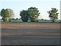
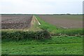
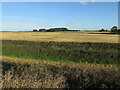
Reclaimed land near Hempsted
by Philip Halling geograph for square SO8017 The land on the left is reclaimed land which used to be a landfill site. The... (more)
|
|
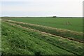
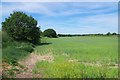
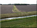
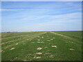
Reclaimed land near Freiston
by Jonathan Thacker geograph for square TF4043 This land was reclaimed in the 1970s. I am standing on a bank which has been... (more)
|
|
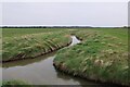
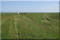
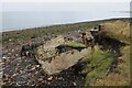
Field inside sea wall
by Hugh Venables geograph for square TF4531 Reclaimed land from the saltmarshes of the Wash (despite the word... (more)
Tags:
Arable LandX
top:Farm, Fishery, Market GardeningX
FensX
top:Flat LandscapesX
type:GeographX
Reclaimed Land
|
|
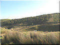
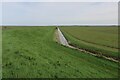
Reclaimed spoil heap, Swinden Quarry
by Stephen Craven geograph for square SD9761 Category: Reclaimed land The back (north-west) side of Swinden Quarry consists of a row of spoil heaps.... (more)
|
|
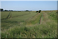
Reclaimed land in Vinegar Middle
by Hugh Venables geograph for square TF6024 Looking towards the old sea bank. The land in between was claimed from the salt... (more)
Tags:
Arable LandX
top:Farm, Fishery, Market GardeningX
top:Flat LandscapesX
type:GeographX
Reclaimed Land
|
|
Reclaimed land outside the old Sea Bank
by Hugh Venables geograph for square TF3437 Really the land is just "claimed" as it was last dry ground about 8000... (more)
Tags:
Arable LandX
top:Farm, Fishery, Market GardeningX
top:Flat LandscapesX
type:GeographX
Reclaimed Land
|
|
Reclaimed land outside the old Sea Bank
by Hugh Venables geograph for square TF3437 Really the land is just "claimed" as it was last dry ground about 8000... (more)
Tags:
Arable LandX
top:Farm, Fishery, Market GardeningX
top:Flat LandscapesX
type:GeographX
Reclaimed Land
|

|
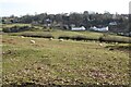
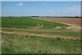
Dike and reclaimed farmland near Ongar Hill
by Richard Humphrey geograph for square TF5625 Land reclaimed from The Wash during the 20th Century
|
|
Farmland near Lodge Farm, Lutton Marsh
by Richard Humphrey geograph for square TF4627 A recently drilled field in this vast area of reclaimed land from The Wash
|
|
Reclaimed land inside the sea wall
by Hugh Venables geograph for square TF6025 The bushes at the back are along the old sea wall, with the land claimed from... (more)
Tags:
Arable LandX
top:Farm, Fishery, Market GardeningX
top:Flat LandscapesX
type:GeographX
Reclaimed Land
SeawallX
|
|
Reclaimed land outside the old Sea Bank
by Hugh Venables geograph for square TF3437 More arable land claimed from the saltmarsh of the Wash by a subsequent sea wall.
Tags:
Arable LandX
top:Farm, Fishery, Market GardeningX
top:Flat LandscapesX
type:GeographX
Old Sea BankX
Reclaimed Land
|

|
Bee orchid, Belfast harbour estate (June 2019)
by Albert Bridge for square J3778 Not particularly knowledgeable about wildflowers but I think this is a bee... (more)
Tags:
plant:Bee OrchidX
place:BelfastX
Belfast HarbourX
type:Close LookX
top:Docks, HarboursX
subject:FlowerX
OrchidX
Reclaimed Land
top:Wild Animals, Plants and MushroomsX
WildflowerX
|

|
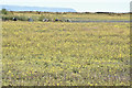
Margam Moors from the Wales Coast Path
by eswales geograph for square SS7884 The image shows some of the low-lying reclaimed land of Margam Moors with part... (more)
|

|
Former landfill site
by Philip Halling geograph for square SO8018 The land on the left has been reclaimed having previously been a landfill site,... (more)
|
|
Reclaimed land
by Hugh Venables geograph for square TF6329 Inside the seawall by The Wash.
Tags:
Arable LandX
top:Farm, Fishery, Market GardeningX
top:Flat LandscapesX
type:GeographX
Reclaimed Land
|
|
Reclaimed land, Wootton Marsh
by Hugh Venables geograph for square TF6127 Claimed from the saltmarsh of The Wash by the seawall and drainage ditches.
Tags:
Arable LandX
top:Farm, Fishery, Market GardeningX
top:Flat LandscapesX
type:GeographX
Reclaimed Land
|
|
Reclaimed land, Wootton Marsh
by Hugh Venables geograph for square TF6126 From the sea wall by (what is left of) The Wash.
Tags:
Arable LandX
top:Farm, Fishery, Market GardeningX
top:Flat LandscapesX
type:GeographX
Reclaimed Land
|
|
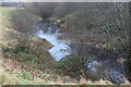
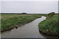
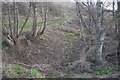
Old creek in the reclaimed land
by Hugh Venables geograph for square TF6429 Tags:
Arable LandX
top:Farm, Fishery, Market GardeningX
top:Flat LandscapesX
type:GeographX
Reclaimed Land
|
|
Reclaimed land inside the sea wall
by Hugh Venables geograph for square TF6127 Tags:
Arable LandX
top:CoastalX
top:Farm, Fishery, Market GardeningX
type:GeographX
Reclaimed Land
SeawallX
The WashX
|
|
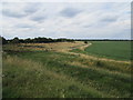
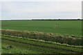
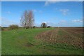
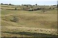
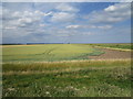
Arable field on Deepdale Marsh
by Hugh Venables geograph for square TF8044 The rest of this segment of reclaimed land is now grazing marsh.
|
|
Spring Cereal Near Hamford Water
by Glyn Baker geograph for square TM2127 I am assuming by the height of the earthwork to the left this is reclaimed land
|

|
Fungus, Belfast harbour (September 2019)
by Albert Bridge for square J3778 Part of an extensive growth, in the moss-covered reclaimed site, beside the Airport Road.
Tags:
place:BelfastX
Belfast HarbourX
type:Close LookX
top:Docks, HarboursX
FungiX
subject:FungiX
FungusX
MossX
Reclaimed Land
top:Wild Animals, Plants and MushroomsX
|
|
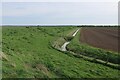
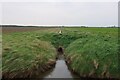
Path along the sea wall of The Wash
by Hugh Venables geograph for square TF4730 With reclaimed land to the right and the remaining saltmarsh to the left.
|
|
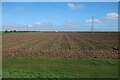
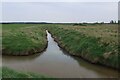
Ditch and field inside the sea wall
by Hugh Venables geograph for square TF4432 Reclaimed land by the Wash.
Tags:
Arable LandX
top:Farm, Fishery, Market GardeningX
FensX
top:Flat LandscapesX
type:GeographX
Reclaimed Land
|
|
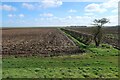
Field on Gedney Marsh
by Hugh Venables geograph for square TF4432 Reclaimed land from the saltmarshes of the Wash. Now prime farmland.
Tags:
Arable LandX
top:Farm, Fishery, Market GardeningX
FensX
top:Flat LandscapesX
type:GeographX
Reclaimed Land
|
|
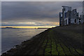
West Breakwater, Leith Western Harbour
by Ian Taylor geograph for square NT2577 Looking NE along the old breakwater. This now forms the sea wall for the... (more)
Tags:
Apartment BlocksX
subject:BreakwaterX
top:CoastalX
Firth of ForthX
type:GeographX
top:Housing, DwellingsX
Leith HarbourX
Reclaimed Land
Sea WallX
|
|
Mustard Pond, Parc Nant-y-Waun
by M J Roscoe geograph for square SO1811 Pond on reclaimed land at the eastern end of Parc Nant-y-Waun.
Tags:
place:BrynmawrX
type:GeographX
top:Lakes, Wetland, BogX
top:Park and Public GardensX
Reclaimed Land
top:Suburb, Urban FringeX
Trees and Bushes in WinterX
|
|
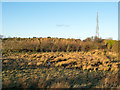
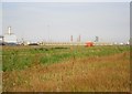
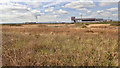
Aerial and reclaimed land
by Trevor Littlewood geograph for square NZ2024 A few years ago the area in view showed a great cavity as the land was being... (more)
Tags:
AerialX
subject:Aerial (Antenna)X
top:CommunicationsX
top:Derelict, DisusedX
top:Farm, Fishery, Market GardeningX
top:Lakes, Wetland, BogX
top:LowlandsX
MarshX
PlantationX
top:Quarrying, MiningX
Reclaimed Land
|
|
VT4 berth, Belfast harbour (June 2015)
by Albert Bridge for square J3678 The Ferry Stena Superfast VII at berth VT4 (Victoria Terminal no 4) at the... (more)
|
|
Land reclaimed from The Wash near Ongar Hill
by Richard Humphrey geograph for square TF5725 On the 1940 O.S. map all of this land was part of The Wash. The coast line was a... (more)
|
|
View Towards Hir Ynys, Gwynedd
by Peter Trimming geograph for square SH6039 Hir Ynys, an island prior to the building of 'The Cob' embankment,... (more)
Tags:
top:Farm, Fishery, Market GardeningX
top:Flat LandscapesX
top:GrasslandX
place:GwyneddX
HirX
Reclaimed Land
country:WalesX
YnysX
|
|
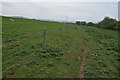
Footpath to Lord's Clough
by Jonathan Thacker geograph for square TA1527 The land immediately to the right has been recently reclaimed from the Humber.
Tags:
top:PathsX
Reclaimed Land
|
|
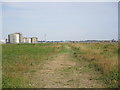
New shoreline
by Jonathan Thacker for square TA1527 The land ahead has been recently reclaimed but as yet is not being used.
Tags:
top:Estuary, MarineX
Reclaimed Land
|
|
View towards Salt End
by Jonathan Thacker for square TA1527 Looking across recently reclaimed land.
Tags:
top:IndustryX
Reclaimed Land
|
|
Old creek in the reclaimed land
by Hugh Venables geograph for square TF6429 |
|
Old creek in reclaimed land
by Hugh Venables geograph for square TF6328 |
|
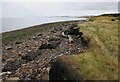
Coastal erosion
by Richard Sutcliffe geograph for square NT3774 This area of land was reclaimed from the sea. A hundred years ago, this spot was... (more)
Tags:
top:CoastalX
subject:ErosionX
top:Estuary, MarineX
type:GeographX
Reclaimed Land
top:Rocks, Scree, CliffsX
|
|
Eroding shore near Prestonpans
by Richard Sutcliffe geograph for square NT3774 This area of land was reclaimed from the sea. A hundred years ago, this spot was... (more)
Tags:
top:CoastalX
Coastal ErosionX
top:Estuary, MarineX
type:GeographX
Reclaimed Land
top:Rocks, Scree, CliffsX
subject:ShoreX
|
|
|
St Osyth Salt Marsh and Sea Wall Panorama
by Glyn Baker geograph for square TM1212 Looking along St Osyth Footpath 18 with surviving marsh on the left and... (more)
|
|
A post industrial landscape
by Philip Halling geograph for square SO6217 A post industrial landscape at Ruardean. This land has been reclaimed having... (more)
Tags:
top:Farm, Fishery, Market GardeningX
FarmlandX
subject:FarmlandX
FieldsX
type:GeographX
Reclaimed Land
top:Village, Rural SettlementX
|
|
Post industrial landscape
by Philip Halling geograph for square SO6216 In the past this land at Ruardean Woodside was a coalmine. This post industrial... (more)
Tags:
top:Farm, Fishery, Market GardeningX
subject:FieldX
FieldX
type:GeographX
Post Industrial LandscapeX
Reclaimed Land
|
|
Footpath along the former sea bank
by Jonathan Thacker geograph for square TF4346 The land to the left was reclaimed in the nineteenth century; to the right in 1972.
|
|
Frampton Marsh
by Hugh Venables geograph for square TF3537 Reclaimed farmland, close to the RSPB reserve where farmland has been converted... (more)
Tags:
Arable LandX
top:Farm, Fishery, Market GardeningX
top:Flat LandscapesX
type:GeographX
Reclaimed Land
|
|
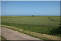
Wheat by The Wash
by Jonathan Thacker geograph for square TF4143 The wheat is on land reclaimed during the 1970s. The Wash is immediately beyond... (more)
|
|
Site of former tile works
by Ian Capper geograph for square TQ2351 Reclaimed land, now used to graze cattle, on what was in the 1930s a tile works... (more)
Tags:
road:Cliftons LaneX
top:Derelict, DisusedX
top:Farm, Fishery, Market GardeningX
type:GeographX
Reclaimed Land
place:ReigateX
Tile WorksX
|
|
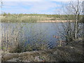
New lake, east of Old Park Farm
by Christine Johnstone geograph for square SE3521 'Ferryboat Fields' is reclaimed land in the Southern Washlands nature corridor.
Tags:
type:GeographX
subject:LakeX
top:Lakes, Wetland, BogX
Reclaimed Land
place:Southern WashlandsX
|
|
Reclaimed land
by Mick Garratt geograph for square NZ5726 |
|
Ditch, Levenhall Links
by Richard Webb geograph for square NT3573 On the vast area of reclaimed land where flyash from Cockenzie power station was dumped.
Tags:
type:GeographX
top:Park and Public GardensX
Reclaimed Land
top:Rivers, Streams, DrainageX
top:Woodland, ForestX
|
|
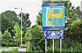
Duncrue Estate sign, Belfast (July 2017)
by Albert Bridge for square J3477 Approximately two thirds of this square is land reclaimed from Belfast Lough.... (more)
Tags:
place:BelfastX
Belfast City CouncilX
top:Business, Retail, ServicesX
type:Close LookX
Industrial EstateX
Reclaimed Land
subject:SignX
SignX
|