|
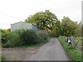
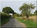
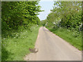
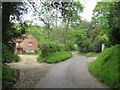
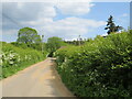
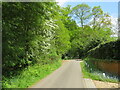
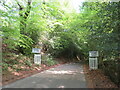
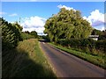
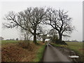
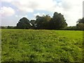
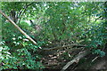
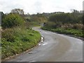
Laundry Lane, Little Easton, near Great Dunmow
by Malc McDonald
geograph for square TL6023
Laundry Lane is a minor lane in north Essex countryside, near and through the... (more)
|
|
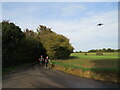
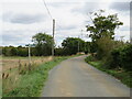
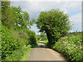
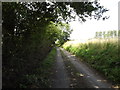
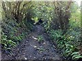
Brick End Lane, near Stansted Airport
by Malc McDonald
geograph for square TL5626
Bricl End Lane is a minor lane in north Essex countryside. It lies under the... (more)
|
|
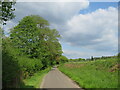
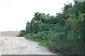
Waybutt Lane, Chorlton
by Scott Robinson
geograph for square SJ7349
Looking north along Waybutt lane, Chorlton. This lane runs alongside the... (more)
|
|
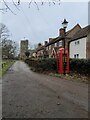
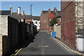
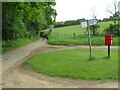
Telephone Box, Church Lane, Cardington
by PAUL FARMER
geograph for square TL0847
|
|
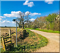
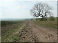
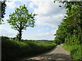
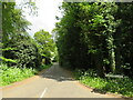
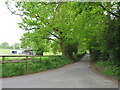
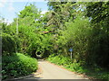
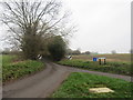
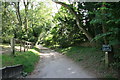
Lane near Puckeridge
by Malc McDonald
geograph for square TL3422
An un-named minor lane through north Hertfordshire countryside.
|
|
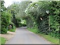
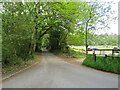
Throcking Lane, near Buntingford
by Malc McDonald
geograph for square TL3531
Throcking Lane is a minor lane through countryside in north Hertfordshire.... (more)
|
|
Henry-Turner Street Back lane
by Luke Jones
geograph for square NZ6025
Small back lane connecting Turner and Henry Street in Redcar.
|
|
Tree on Green Lane, looking west
by Christine Johnstone
geograph for square SE9361
York Road Green Lane is undergoing planned maintenance to get rid of many very... (more)
|
|
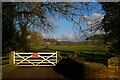
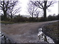
Gated road in Cottesbrooke Park
by Christopher Hilton
geograph for square SP7074
The lane here passes through an area of sheep pasture, necessitating gates... (more)
|
|
Mallows Green Road, near Manuden
by Malc McDonald
geograph for square TL4626
Mallows Green Road is a minor lane in north Essex countryside, close to the... (more)
|
|
Protest sign at Pilsley
by Trevor Rickard
geograph for square SK2371
Looking north along Bradley Lane. This green lane has been the subject of a... (more)
|
|
Thornton Lane/Black Lane crossroads
by Hugh Craddock
geograph for square TR2953
Thornton Lane, at the former crossroads with Black Lane. The opening to Black... (more)
|
|
Hungary Lane
by Alan Murray-Rust
geograph for square SK5125
Early OS maps show it as 'Hungry Lane', suggesting that the area it... (more)
|
|
Footpath & entrance to Kings Farm
by Geographer
geograph for square TM4468
Footpath leads to Westleton Common & Baker's Lane
|
|
Longload Lane
by Ian Calderwood
geograph for square SK2756
Longload Lane used to run into Dean Hollow, where it met Yeats Lane, which ran... (more)
|
|
No parking on Lenton Lane
by Ian Calderwood
geograph for square SK5636
This part of Lenton Lane used to be called Trent Lane and led to Wilford Ford.... (more)
|
|
Wishanger Lane, near Farnham
by Malc McDonald
geograph for square SU8438
Wishanger Lane is a minor road through countryside on the borders of Hampshire... (more)
|
|
Bacon Lane, near Farnham
by Malc McDonald
geograph for square SU8439
Bacon Lane is a minor lane through countryside on the borers of Hampshire and... (more)
|

|
Frensham Lane, near Bordon
by Malc McDonald
geograph for square SU8338
Frensham Lane is a minor lane through Hampshire countryside, close to the border... (more)
|
|
Frensham Lane, near Bordon
by Malc McDonald
geograph for square SU8338
Frensham Lane is a minor lane through Hampshire countryside, close to the border... (more)
|
|
Smithfield Lane, near Bordon
by Malc McDonald
geograph for square SU8338
Smithfield Lane is a minor lane through the Hampshire countryside, close to the... (more)
|
|
Smithy Lane, near Bordon
by Malc McDonald
geograph for square SU8238
Smithy Lane is a minor road through the Hampshire countryside.
|
|
Smithy Lane, near Bordon
by Malc McDonald
geograph for square SU8238
Smithy Lane is a minor road passing through countryside in Hampshire.
|
|
Smithy Lane, near Bordon
by Malc McDonald
geograph for square SU8238
Smithy Lane is a minor road through countryside in Hampshire.
|
|
Hurland Lane, near Headley
by Malc McDonald
geograph for square SU8235
Hurland Lane is a narrow lane through Hampshire countryside near the village of Headley.
|
|
Hurland Lane, near Bordon
by Malc McDonald
geograph for square SU8235
Hurland Lane is a minor lane through Hampshire countryside. Here it passes a... (more)
|
|
Hurland Lane, near Bordon
by Malc McDonald
geograph for square SU8235
Hurland Lane is a minor lane through Hampshire countryside. Here it passes a... (more)
|
|
Gentles Lane, near Bordon
by Malc McDonald
geograph for square SU8335
Gentles Lane is a minor lane through Hampshire countryside.
|
|
Gentles Lane, near Bordon
by Malc McDonald
geograph for square SU8335
Gentles Lane is a minor lane through Hampshire countryside.
|
|
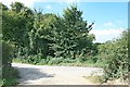
Tunbridge Lane, Bramshott, near Liphook
by Malc McDonald
geograph for square SU8333
Tunbridge Lane entering the village of Bramshott, near Liphook in Hampshire.
|
|
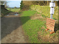
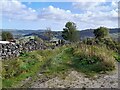
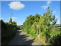
Minor country lane near Liss
by Malc McDonald
geograph for square SU8028
A narrow lane in the South Downs National Park. The blue sign indicates that... (more)
|
|
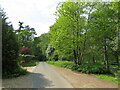
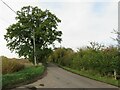
Duck Street, Little Easton, near Great Dunmow
by Malc McDonald
geograph for square TL6024
Duck Street is a minor road in north Essex countryside. It passes through the... (more)
|
|
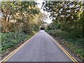
Bower Lane, Eynsford
by Malc McDonald
geograph for square TQ5465
Bower Lane is a narrow country lane in Kent. Here, the sign indicates the speed... (more)
|
|
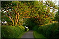
Weeping willow caught in a summer breeze, Breach Oak Lane, Astley
by A J Paxton
geograph for square SP3087
We are looking east along Breach Oak Lane towards the junction with Howe Green... (more)
|
|
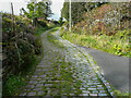
Tyas Lane. Slaithwaite
by Humphrey Bolton
geograph for square SE0514
Further up the lane the surface of the lane is tarmac.
|
|
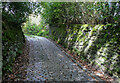
Tyas Lane, Slaithwaite
by Humphrey Bolton
geograph for square SE0514
This lowest part of the lane is paved with granite setts, but a section seems to... (more)
|
|
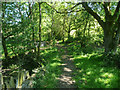
Stony Lane, Southowram
by Humphrey Bolton
geograph for square SE1224
Stony Lane goes from Church Lane to Walter Clough Lane, and it is both a public... (more)
|
|
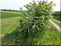
Sheepcote Lane, near Manuden
by Malc McDonald
geograph for square TL4827
Sheepcote lane is a minor lane through countryside in north Essex, near the... (more)
|
|
Butt Lane, near Manuden
by Malc McDonald
geograph for square TL4826
Butt Lane is a minor lane in north Essex countryside, near the village of... (more)
|
|
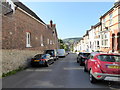
Watts Lane, Eastbourne
by PAUL FARMER
geograph for square TV6099
|
|
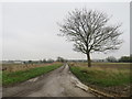
Packington Nook Lane, near Ashby
by Oliver Mills
geograph for square SK3515
Taken at sunset, looking towards the farm at the south end of the lane (a... (more)
|
|
Course of Black Lane
by Hugh Craddock
geograph for square TR2853
The disturbed ground stretching away to the east is the course of Black Lane, an... (more)
|
|
Course of Black Lane
by Hugh Craddock
geograph for square TR2853
The slight depression on the left is the course of Black Lane, an old sunken way... (more)
|
|
Deadman's Lane, Stoke Ash
by Geographer
geograph for square TM1269
Looking towards the Ford near Water Lane footpath
|
|
Black Lane from Thornton Lane
by Hugh Craddock
geograph for square TR2953
The choked course of Black Lane east from the crossroads on Thornton Lane.
|
|
Black Lane
by Hugh Craddock
geograph for square TR2853
A view along the sunken course of Black Lane. Although this section of the lane... (more)
|
|
Knowlton Lane beyond St Clement's church
by Hugh Craddock
geograph for square TR2853
Knowlton Lane ceases to be regarded as a public road just beyond the entrance to... (more)
|
|
Pettycrate Lane
by Hugh Craddock
geograph for square SY4192
Pettycrate Lane a short distance above the last dwelling served by the lane.... (more)
|
|
Hedgerow on Fulmer Lane near Castle Acre
by Richard Humphrey
geograph for square TF8015
|
|
View down May Lane towards Pudlicott Lane
by David P Howard
geograph for square SP1839
Category: Country lane
Looking SE from where the footpath to Paxford leaves May Lane, towards the... (more)
|