Public Tags
Other tags: Track Junction
category:Track Junction
Showing latest 50 of 909 images tagged with subject:Track Junction tag.
|
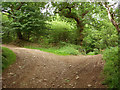
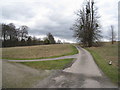
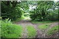
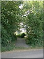
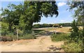
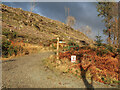
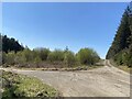
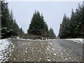
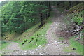
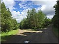
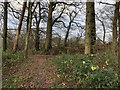
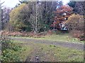
Track junction at the south west corner of Coed Cwm Kenfig
by eswales geograph for square SS8385 Category: Track junction A junction of tracks, both also footpaths, in a pleasant deciduous area on the... (more)
|
|
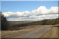
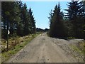
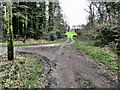
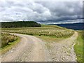
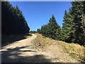
Track junction at Afan Forest Park
by eswales geograph for square SS8193 Category: Track junction A track junction with waymark on Mynydd Penhydd.
|
|
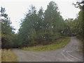
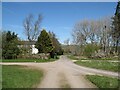
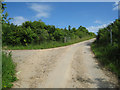
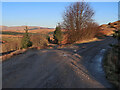
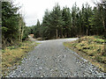
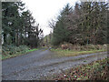
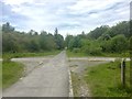
Track junction in the north of Coed Cwm Kenfig
by eswales geograph for square SS8387 Category: Track junction Although the track to the left (which continues behind the photographer's... (more)
Tags:
Cwm CynffigX
Cwm KenfigX
top:PathsX
TrackX
subject:Track Junction
Track Junction
top:Woodland, ForestX
|
|
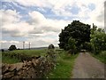
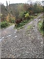
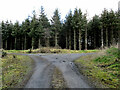
Junction of two tracks
by Robert Graham geograph for square NZ0751 This is the junction of a track running north from Derwent Manor Hotel with the... (more)
Tags:
Dry Stone WallX
Field PathX
type:GeographX
top:LowlandsX
top:PathsX
top:Roads, Road TransportX
Track Junction
subject:Track Junction
|
|
Track to The Lodge
by Mr Ignavy geograph for square SU6550 Category: Track / path junction Just beyond the trees to the right of the track is a cricket ground.
Tags:
Track / Path JunctionX
subject:Track Junction
|
|
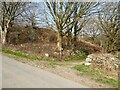
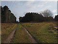
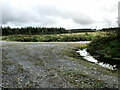
Tracks at Nether Row
by Adrian Taylor geograph for square NY3237 Nether Row comprises little more than a scattering of houses and a junction of... (more)
Tags:
CumbriaX
Cumbria WayX
Cumbria Way Alternative RouteX
type:GeographX
Junction of TracksX
Nether RowX
top:Roads, Road TransportX
The Cumbria WayX
long distance path:The Cumbria WayX
ldp:The Cumbria WayX
The Cumbria Way Alternative RouteX
subject:Track Junction
TracksX
top:Village, Rural SettlementX
|
|
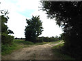
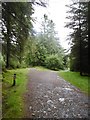
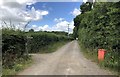
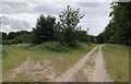
Lane entrance near Brookside
by Adrian Taylor geograph for square SD2389 Leading from the road near Brookside the lane leads to Buttstead Wood and... (more)
|
|
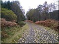
Track junction
by Aleks Scholz geograph for square NN5831 Fall leaves on the tracks. This is the junction between two paths through the... (more)
Tags:
type:GeographX
top:PathsX
top:Rivers, Streams, DrainageX
subject:Track Junction
top:Woodland, ForestX
|
|
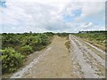
Track junction off Troed-y-rhiw Road
by M J Roscoe geograph for square ST1995 Two tracks leave the road almost opposite its junction with a byway and cross... (more)
|
|
Track junction
by David Pashley geograph for square TL7998 Track junction with Cold Harbour cottage in background.
Tags:
Breckland NorfolkX
top:Flat LandscapesX
type:GeographX
top:PathsX
Thetford ForestX
subject:Track Junction
Track Junction
top:Woodland, ForestX
|
|
Track junction
by Lairich Rig geograph for square NS5079 The junction of tracks is depicted on the 1:25000 and 1:50000 maps. The track... (more)
Tags:
type:GeographX
long distance path:John Muir WayX
top:Roads, Road TransportX
subject:Track Junction
|
|
Track junction south of Quarry Road, Ryde
by Jaggery geograph for square SZ5991 A minor track on the right diverges from the well-trodden track on the left,... (more)
|
|
Northbourne Road: junction with Lonely Lane along west side of Updown House park
by Hugh Craddock geograph for square TR3153 Turning off the Northbourne Road down a track along the west side of Updown... (more)
|
|
Parting of ways
by Mr Ignavy geograph for square SY7995 Category: Track / path junction Footpath to the left, farm track straight ahead.
Tags:
Track / Path JunctionX
subject:Track Junction
|
|
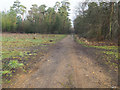
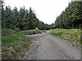
Forest track junction
by jeff collins geograph for square SX5260 Left hand track heads towards Ramage Wood. Right hand track comes from Cann... (more)
|
|
Track junction
by David Pashley geograph for square TL9392 Junction of forest paths with forest road 83
Tags:
Breckland NorfolkX
top:Flat LandscapesX
type:GeographX
top:PathsX
top:Roads, Road TransportX
Thetford ForestX
subject:Track Junction
Track Junction
top:Woodland, ForestX
|
|
Track Junction
by Chris Thomas-Atkin geograph for square TQ3416 A track junction beside the railway line. In the field beyond the junction new... (more)
|
|
Track junction, Cwmcarn Forest
by M J Roscoe geograph for square ST2392 Junction of minor and major forestry tracks on the side of Cwm Byr.
Tags:
Conifer PlantationX
Forestry TrackX
type:GeographX
top:Roads, Road TransportX
subject:Track Junction
top:UplandsX
top:Woodland, ForestX
|
|
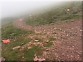
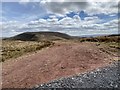
Track Junction towards Craig Cwm Llwch
by Alan Hughes geograph for square SO0020 High visibility track markers at the Craig Cwm Llwch / Pont ar Daf track... (more)
|
|
Track off Grove Road
by Geographer geograph for square TM1584 Tags:
top:Farm, Fishery, Market GardeningX
type:GeographX
GissingX
at:GissingX
Grove RoadX
off:Grove RoadX
top:Roads, Road TransportX
subject:TrackX
TrackX
Track Junction
subject:Track Junction
|
|
Track junction
by Lairich Rig geograph for square NS4979 The junction is depicted on the map at 1:25000 and 1:50000 scales. The John Muir... (more)
Tags:
Forestry TrackX
type:GeographX
long distance path:John Muir WayX
top:Roads, Road TransportX
subject:Track Junction
|
|
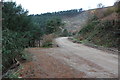
South Barrule, forestry track junction
by Mike Faherty geograph for square SC2776 Mountain bike routes in the forest park.... (more)
Tags:
top:CoastalX
Forestry Track JunctionX
top:IslandsX
Mountain Bike TrackX
top:Roads, Road TransportX
top:Sport, LeisureX
subject:Track Junction
top:UplandsX
top:Woodland, ForestX
|
|
Beaulieu Heath, forestry track junction
by Mike Faherty geograph for square SU4104 The wayfarer has a choice of two tracks from Hardley Bridge to Beaulieu Road and beyond.
Tags:
top:Flat LandscapesX
Forestry Track JunctionX
top:Heath, ScrubX
Open ForestX
top:Roads, Road TransportX
subject:Track Junction
|
|
Pilley, forestry track junction
by Mike Faherty geograph for square SZ3498 OS appears to show this area as a desert; perhaps unfairly, as there are signs... (more)
Tags:
top:Flat LandscapesX
Forestry Track JunctionX
top:Heath, ScrubX
Open ForestX
top:Roads, Road TransportX
subject:Track Junction
|
|
Forest track junction in Ardgartan Forest
by wrobison geograph for square NN2601 A forest track/cycle trail leaves the Loch Lomond and Cowal Way at this... (more)
Tags:
type:GeographX
top:Roads, Road TransportX
top:Sport, LeisureX
subject:Track Junction
top:Woodland, ForestX
|
|
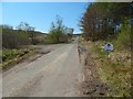
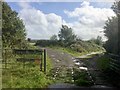
Track junction near Middlegill
by wrobison geograph for square NT0306 The main track on the left is the access route to several remote cottages. The... (more)
|
|
Track junction
by Chris Thomas-Atkin geograph for square SU8717 The track junction near Crypt Farm.
|
|
Track Junction
by kevin higgins geograph for square S3555 Junction of tracks in forest at Ballybeagh, about 3.5km W of Tullaroan.
|
|
Track junction
by Alan Hughes geograph for square SN8603 Track junction on Mynydd Resolven.
Tags:
type:GeographX
top:Roads, Road TransportX
subject:Track Junction
top:UplandsX
top:Woodland, ForestX
|
|
Track Junction
by kevin higgins geograph for square S4834 Junction of forest tracks in Castlemorres forest, about 6km SW of Knocktopher.
|
|
Track Junction
by kevin higgins geograph for square S6141 Junction of forest tracks at Columbkille, about 2.5km E of Thomastown.
|
|
Track Junction
by kevin higgins geograph for square S5949 Junction of forest tracks at Castlefield about 2km NW of Dungarvan.
|
|
Track junction
by Alan Hughes geograph for square ST0197 Track junction in St Gwynno Forest.
|
|
Track Junction
by kevin higgins geograph for square S3928 Junction of forest tracks on Carrigadoon Hill, about 7km N of Carrick-on-Suir.
|
|
Track Junction
by kevin higgins geograph for square S6546 Junction of tracks in felled forest with communications masts on Croghan Hill... (more)
|
|
Track Junction
by Chris Thomas-Atkin geograph for square TQ1226 The junction of tracks near Sumners Pond.
|
|
Track junction, Cwm Big
by M J Roscoe geograph for square SO2004 Tracks in oak woodland, Coed Big; the left hand track comes up from Aberbeeg.
Tags:
type:GeographX
Oak WoodlandX
top:Roads, Road TransportX
Stony TrackX
subject:Track Junction
top:UplandsX
Wooded HillsideX
top:Woodland, ForestX
|
|
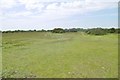
Track junction near Shepherds Croft
by Chris Thomas-Atkin geograph for square SU9114 On the track known as New Road at the junction with public footpath 427 off to the left.
|
|
Track junction
by Alan Hughes geograph for square SN9019 An interesting juxtaposition of track materials. The older track on the left... (more)
Tags:
type:GeographX
top:Geological InterestX
top:Roads, Road TransportX
subject:Track Junction
top:UplandsX
|
|
Farm track junction
by Alan Hughes geograph for square SS5392 Track junction leading to Little Hills Farm and Malthouse Farm.
|
|
Track junction
by Alan Hughes geograph for square SS8199 Track junction near Banwen Torybetel.
|
|
Track junction
by Alan Hughes geograph for square SS8399 To the left is one of several tracks known as St Illtyds walk. The older track... (more)
Tags:
type:GeographX
top:Historic Sites and ArtefactsX
top:PathsX
subject:Track Junction
top:UplandsX
|
|
Track junction
by Alan Hughes geograph for square SN3802 Track junction in Pembrey Forest.
|
|
Track junction
by Alan Hughes geograph for square SS9592 Track junction In woodland on Mynydd William Meyrick.
|
|
Track junction
by Alan Hughes geograph for square SS9593 Track junction on Mynydd William Meyrick.
|
|
Track junction
by Alan Hughes geograph for square SS8289 Track junction on Mynydd Margam.
|
|
Track Junction
by Chris Thomas-Atkin for square SU9924 A muddy track junction near Stedmans Journey.
|
|
Track Junction
by Chris Thomas-Atkin geograph for square SU9122 Approaching the track junction beside Heathend Copse.
|
|
Track junction
by Alan Hughes geograph for square SN7606 Junction of tracks in woodland near Tareni Gleision.
|
|
Track Junction
by kevin higgins geograph for square S3034 Junction of forest tracks on north side of Slievenamon.
|