Public Tags
Showing latest 50 of 466 images tagged with subject:Wetland tag.
|
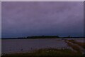
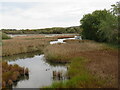
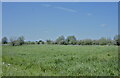
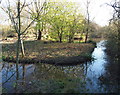
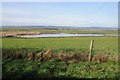
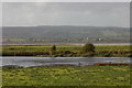
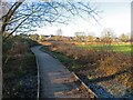
The Ouse Washes: Welney Wildfowl and Wetlands Trust centre
by Christopher Hilton geograph for square TL5494 Seen here, looking back from the wetland reserve, is the footbridge from the WWT... (more)
Tags:
subject:BridgeX
bridge:FootbridgeX
FootbridgeX
type:GeographX
top:Lakes, Wetland, BogX
WetlandX
subject:Wetland
Wetland ReserveX
Wetlands CentreX
Wildfowl and Wetlands TrustX
Wildlife CentreX
WWT Welney Wetland CentreX
|
|
Arundel Wetlands Centre
by PAUL FARMER geograph for square TQ0207 Tags:
ArundelX
place:ArundelX
top:Educational SitesX
type:GeographX
top:Lakes, Wetland, BogX
subject:Nature ReserveX
subject:Wetland
Wetland CentreX
Wetland ReserveX
|
|
Arundel Wetlands Centre
by PAUL FARMER geograph for square TQ0208 Tags:
place:ArundelX
ArundelX
top:Educational SitesX
type:GeographX
top:Geological InterestX
top:Lakes, Wetland, BogX
subject:Nature ReserveX
subject:Wetland
Wetland CentreX
Wetland ReserveX
|
|
Arundel Wetland Centre - View from the boat
by Rob Farrow geograph for square TQ0208 At WWT Arundel Wetland Centre you can take a little boat which traverses some... (more)
Tags:
place:ArundelX
top:Educational SitesX
type:GeographX
top:Lakes, Wetland, BogX
subject:Wetland
Wetland CentreX
top:Wild Animals, Plants and MushroomsX
|
|
Ouse Washes, Welney Wetland and Wildfowl Trust centre
by Christopher Hilton geograph for square TL5495 |
|
The Ouse Washes: Welney Wildfowl and Wetlands Trust centre
by Christopher Hilton geograph for square TL5494 Tags:
DucksX
fowl:DucksX
FensX
type:GeographX
LakeX
top:Lakes, Wetland, BogX
birds:MallardX
MallardX
duck:MallardX
bird:MallardX
bird:Mallard DuckX
Mallard DucksX
bird:PochardX
WetlandX
subject:Wetland
Wetland ReserveX
Wetlands CentreX
Wildfowl and Wetlands TrustX
Wildlife CentreX
WWT Welney Wetland CentreX
|
|
Thatched Building at Arundel Wetland Centre
by PAUL FARMER geograph for square TQ0208 Tags:
place:ArundelX
ArundelX
type:GeographX
top:Lakes, Wetland, BogX
place:SussexX
county:SussexX
Thatched BuildingX
Thatched BuildingsX
subject:Wetland
Wetland CentreX
Wetlands CentreX
|
|
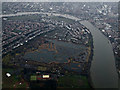
London Wetland Centre from the air
by Thomas Nugent for square TQ2276 The centre is run by the Wildfowl & Wetlands Trust... (more)
|
|
Dodnor Creek nature reserve, near Newport
by Malc McDonald geograph for square SZ5091 Dodnor Creek nature reserve, on the western bank of the River Medina estuary on... (more)
Tags:
top:Estuary, MarineX
type:GeographX
place:Isle of WightX
top:Lakes, Wetland, BogX
Nature ReserveX
near:NewportX
subject:Wetland
WetlandX
Wetland HabitatX
Wetland ReserveX
Wildlife WetlandX
|
|
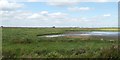
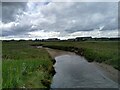
Eype, wetland
by Mike Faherty geograph for square SY4590 Currently dry, but typified by wetland grasses and reeds thriving on run-off... (more)
|
|
Double Locks Wetland
by PAUL FARMER geograph for square SX9389 The wetland was created in 1995
Tags:
county:DevonX
DevonX
top:Flat LandscapesX
type:GeographX
top:Lakes, Wetland, BogX
WetlandX
subject:Wetland
Wetland ReserveX
|
|
Wetland and reedbed by the northern boundary of Kenfig Nature Reserve
by eswales geograph for square SS7882 Category: Wetland A view from the Wales Coast Path at a point towards the northern end of its... (more)
|
|
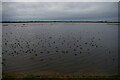
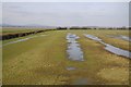
The low wash
by Bob Harvey geograph for square TF1417 One of the three sections of the Baston Fen Nature Reserve, the Low Wash is... (more)
Tags:
near:BastonX
FenlandX
top:Flat LandscapesX
type:GeographX
top:Lakes, Wetland, BogX
county:LincolnshireX
Lincolnshire Wildlife TrustX
subject:Nature ReserveX
The FensX
near:Tongue EndX
subject:Wetland
Wetland ReserveX
|

|
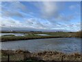
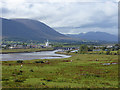
Castle Espie
by Rossographer geograph for square J4967 View at Castle Espie WWT near Comber, across Strangford Lough towards Scrabo... (more)
Tags:
Bird SanctuaryX
place:Castle EspieX
Castle EspieX
top:Educational SitesX
top:Estuary, MarineX
Freshwater LagoonX
type:GeographX
top:Historic Sites and ArtefactsX
place:Strangford LoughX
Strangford LoughX
WetlandX
subject:Wetland
Wetland ReserveX
Wildfowl & Wetlands TrustX
Wildfowl and Wetlands TrustX
Wildfowl ReserveX
Wildfowl SanctuaryX
WWTX
|
|
Burton Mere Wetlands RSPB reserve
by Jonathan Hutchins geograph for square SJ3173 Tags:
rspb reserve:Burton Mere WetlandsX
type:GeographX
top:Lakes, Wetland, BogX
subject:Nature ReserveX
top:Sport, LeisureX
subject:Wetland
top:Wild Animals, Plants and MushroomsX
|
|
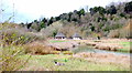
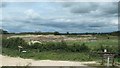
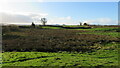
Becoming wetlands, north of Dryham Lane
by Christine Johnstone geograph for square SE8732 The next extension of North Cave Wetlands nature reserve.
|
|
Becoming wetland, west of North Cave wetlands
by Christine Johnstone geograph for square SE8733 The next extension to the nature reserve.
Tags:
type:GeographX
Gravel QuarryX
top:Lakes, Wetland, BogX
North Cave WetlandsX
subject:Wetland
YWT Nature ReserveX
|
|
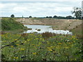
Wetland lagoons, WWT Welney Wetland Centre
by David Smith geograph for square TL5495 Tags:
top:Educational SitesX
type:GeographX
top:Lakes, Wetland, BogX
subject:Wetland
WWT Welney Wetland CentreX
|
|
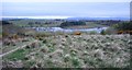
New wetland northwest of Hurlet Hill
by Richard Sutcliffe geograph for square NS5161 This area has developed into a very good wetland since the drainage was altered... (more)
|
|
Wetland at Slimbridge
by Philip Halling geograph for square SO7105 Wetland beside the Severn at Slimbridge's Wildlife and Wetlands Trust site.
|
|
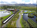
Tralee Bay Wetlands
by Oliver Dixon geograph for square Q8213 Looking WSW from the Observation Tower of the Tralee Bay Wetlands. The mouth of... (more)
|
|
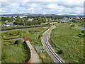
Tralee Bay Wetlands and light railway
by Oliver Dixon geograph for square Q8213 Seen from the Observation Tower in the Tralee Bay Wetlands. Running into the... (more)
|
|
Tralee Bay Wetlands
by Oliver Dixon geograph for square Q8213 Seen from the Observation Tower. Tralee Bay Wetlands is divided into two parts... (more)
|
|
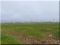
Wetland area, Reading Services
by Philip Halling geograph for square SU6770 A dried up wetland area beside Reading Services.
|
|
Wetlands, Rufford Abbey Country Park, Notts.
by David Hallam-Jones geograph for square SK6464 Part of the wetland area 10-15 minutes walk away from the rear of the main house... (more)
|
|
Wetlands, Rufford Abbey Country Park, Notts.
by David Hallam-Jones geograph for square SK6464 The wetlands are located in the south east corner of Rufford Abbey Country Park.... (more)
|
|
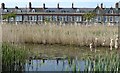
Windsor Esplanade and Cardiff Bay Wetlands Reserve
by Robin Drayton geograph for square ST1874 These Victorian terraced houses once looked out over the mudflats of a tidal... (more)
Tags:
place:Cardiff BayX
Cardiff Bay WetlandsX
top:Lakes, Wetland, BogX
ReedbedX
Victorian Terraced HousesX
subject:Wetland
|
|
Wetland area SW of Berrington
by Rob Bainbridge geograph for square SJ5206 Wetland area SW of Berrington, The Lawley and Caradoc in the background
|
|
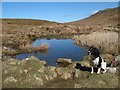
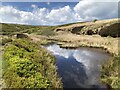
Wetland pool
by Jonathan Wilkins geograph for square SM7328 This pool appears to be too ephemeral to include in the map at any scale, but... (more)
|
|
View to the Severn estuary
by Philip Halling geograph for square SO7104 View to the Severn estuary from the Slimbridge Wildlife and Wetlands Trust.
|
|
Blakemere Moss, Delamere Forest Park
by Jeff Buck geograph for square SJ5471 Blakemere Moss was drained in around 1815, supposedly by prisoners from the... (more)
|
|
Blakemere Moss, Delamere Forest Park
by Jeff Buck geograph for square SJ5571 Blakemere Moss was drained in around 1815, supposedly by prisoners from the... (more)
|
|
Blakemere Moss, Delamere Forest Park
by Jeff Buck geograph for square SJ5471 Blakemere Moss was drained in around 1815, supposedly by prisoners from the... (more)
|
|
|
British Wildlife Centre, Lingfield
by Oast House Archive geograph for square TQ3643 Category: Wetland Wetland area of the centre.
Tags:
top:Lakes, Wetland, BogX
subject:Wetland
|
|
The Dumbles from WWT Slimbridge
by David P Howard geograph for square SO7105 Category: Wetland View NW across The Dumbles and the River Severn from one of the hides at the... (more)
Tags:
top:Lakes, Wetland, BogX
subject:Wetland
|
|
Wetlands close to Redbridge Lane
by Mr Ignavy geograph for square SU6552 Category: Wetland Tags:
top:Lakes, Wetland, BogX
subject:Wetland
|
|
Trackside Wetlands
by Stella Gardiner geograph for square TQ1991 An area of trackside wetlands that was monitored regularly to ensure it... (more)
Tags:
type:GeographX
top:Lakes, Wetland, BogX
top:RailwaysX
top:Rivers, Streams, DrainageX
top:Suburb, Urban FringeX
subject:Wetland
|
|
Wetland south of the River Kelvin
by Richard Sutcliffe geograph for square NS6473 This wetland area is part of the flood plain of the River Kelvin. Large bunds... (more)
|
|
Avon Meadows Community Wetlands, Pershore
by Chris Allen geograph for square SO9546 Boardwalk at the edge of the wetlands.
|
|
Wetlands created by the Lower Otter Restoration Project
by David Smith geograph for square SY0782 The restoration of wetlands between Budleigh Salterton and East Budleigh was a... (more)
Tags:
top:Flat LandscapesX
type:GeographX
top:Lakes, Wetland, BogX
top:Rivers, Streams, DrainageX
subject:Wetland
top:Wild Animals, Plants and MushroomsX
|
|
Slimbridge Wetlands pool
by Pebble geograph for square SO7104 One of the wetland pools at WWT Slimbridge, seen from the Van de Bovenkamp hide.
|
|
Slimbridge Wetlands pool
by Pebble geograph for square SO7105 A small wetland pool in front of the Severn Estuary, as seen from the Holden... (more)
Tags:
type:GeographX
top:GrasslandX
top:Lakes, Wetland, BogX
top:Rivers, Streams, DrainageX
subject:Wetland
|
|
Wetland at River Eden
by Aleks Scholz geograph for square NO4820 This stream meanders through a spit of wetland between Shelly Point and Reres... (more)
Tags:
top:CoastalX
top:Estuary, MarineX
type:GeographX
top:GrasslandX
top:Lakes, Wetland, BogX
top:Rivers, Streams, DrainageX
subject:Wetland
|
|
Wetland on course of Rosedale Ironstone Railway
by David Robinson geograph for square NZ6801 This section of the former railway has become a linear wetland habitat.
|
|
Lone tyre in the wetlands
by Oscar Taylor geograph for square ST5290 A lone tyre in the wetlands south of Mathern, near to the River Severn.
Tags:
top:Energy InfrastructureX
type:GeographX
top:GrasslandX
top:Lakes, Wetland, BogX
subject:Wetland
|
|
Pylons from Mathern Oaze wetland
by Oscar Taylor for square ST5390 Looking at pylons from Mathern Oaze wetland next to the River Severn.
|

|
Mathern Oaze wetland
by Oscar Taylor geograph for square ST5389 Mathern Oaze wetland next to the River Severn. The pylon straight ahead through... (more)
Tags:
top:Energy InfrastructureX
type:GeographX
top:Lakes, Wetland, BogX
top:Rivers, Streams, DrainageX
top:Roads, Road TransportX
subject:Wetland
|
|
Mathern Oaze wetland
by Oscar Taylor for square ST5289 Mathern Oaze wetland next to the River Severn. Through the fog you can just see... (more)
Tags:
type:Cross GridX
top:Energy InfrastructureX
top:Lakes, Wetland, BogX
top:Rivers, Streams, DrainageX
top:Roads, Road TransportX
subject:Wetland
|
|
Mathern Oaze wetland
by Oscar Taylor geograph for square ST5389 Mathern Oaze wetland next to the River Severn.
|
|
Mathern Oaze wetland
by Oscar Taylor geograph for square ST5389 Mathern Oaze wetland next to the River Severn. Through the fog you can just see... (more)
Tags:
type:GeographX
top:Lakes, Wetland, BogX
top:Rivers, Streams, DrainageX
top:Roads, Road TransportX
subject:Wetland
|