|
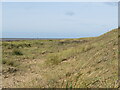
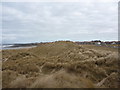
Dunes at St. Anne's-on-the-Sea
by Malc McDonald
geograph for square SD3129
Grassy dunes on the Lancashire coast at St. Anne's-on-the-Sea.
|
|
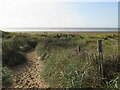
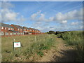
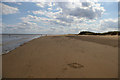
Path to the beach, St. Anne's-on-the-Sea
by Malc McDonald
geograph for square SD3129
A path through the dunes onto the beach at St. Anne's-on-the-Sea, on the... (more)
|
|
Sand dunes, Rossbeigh
by Rossographer
geograph for square V6493
Deep in the heart of the sand dune system at Rossbeigh.
|
|
Sand dunes, Rossbeigh
by Rossographer
geograph for square V6593
Deep in the heart of the sand dune system at Rossbeigh.
|
|
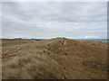
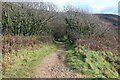
Path through dunes near St. Anne's-on-the-Sea
by Malc McDonald
geograph for square SD3030
A path through grassy dunes near St. Anne's-on-the-Sea.
|
|
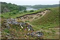
Sand dunes and limestone outcrop, Stackpole Warren
by Simon Mortimer
geograph for square SR9794
Looking northwest, with Bosherston Lily Ponds in the background.
|
|
View across Tràigh Sheileboist towards dunes at Bruaichean Losgaintir
by Doug Lee
geograph for square NG0697
|
|
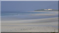
Gibraltar Point: view across the Wash from the dunes
by Christopher Hilton
geograph for square TF5657
The low hills on the horizon are the Norfolk shore of the Wash.
|
|
Looking southwards along the shoreline, Gibraltar Point
by Christopher Hilton
geograph for square TF5658
|
|
Beach house, The Marrams, Sea Palling
by Christopher Hilton
geograph for square TG4227
|
|
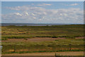
Coastal Northumberland : St Aidan's Dunes, near Seahouses
by Richard West
geograph for square NU2032
A view looking towards Seahouses.
|
|
Coastal Northumberland : St Aidan's Dunes, Seahouses (looking NNW)
by Richard West
geograph for square NU2032
|

|
Memorial plaque and footpath sign, dunes
by M J Roscoe
geograph for square SS0298
|
|
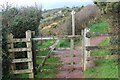
Signpost at path junction, Freshwater East dunes
by M J Roscoe
geograph for square SS0298
Coast Path goes to the left, the path straight ahead goes up to the village.
|
|
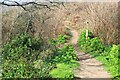
Coast Path about to enter woodland
by M J Roscoe
geograph for square SS0298
Wooded area of dunes at Freshwater East.
|
|
Path through dunes, Freshwater East
by M J Roscoe
geograph for square SS0198
|
|
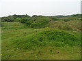
Berrow Local Nature Reserve - The Fore Dunes
by John M
geograph for square ST2953
|
|
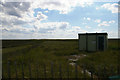
Shorebird Warden's Hut, Gibraltar Point
by Christopher Hilton
geograph for square TF5657
During the breeding season, walkers heading south along the shoreline are... (more)
|
|
Gate on Coast Path at a boundary
by M J Roscoe
geograph for square SS0298
This appears to be the eastern boundary of the local nature reserve on the dunes.
|
|
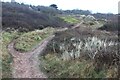
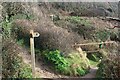
Signpost at path junction near railings in dunes
by M J Roscoe
geograph for square SS0298
Signpost on Coast Path with another signpost, background centre, also on the path.
|
|
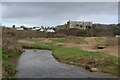
Manorbier Castle, south west aspect
by M J Roscoe
geograph for square SS0697
|