Your search for images, by Kevin Philpott, in reverse Date Submitted order, returns
192 images:
( Page 1 2 3 4 5 6 7 8 ... next >> last ) [refine search]
[quick refine]

|
Sheriff's Kettle
by Kevin Philpott geograph for square NO7772 Tags: [top:Derelict, Disused] [top:Energy infrastructure] [top:Grassland] [top:Heath, Scrub] [top:Historic sites and artefacts] [top:People, Events] [top:Uplands] [type:Geograph] [subject:historical] This depression in an industrial wasteland is allegedly where John Melville, sheriff of the Mearns, was boiled to death by four Mearns lairds in about 1420 for offences... (more)
|

|
Verdant Paradise
by Kevin Philpott geograph for square NO2553 Tags: [top:Geological interest] [top:Rivers, Streams, Drainage] Just to prove there was at least one decent day in the summer of 2012!
|

|
Norman Arch, Edrom
by Kevin Philpott for square NT8255 Tags: [top:Burial ground, Crematorium] [top:Flat landscapes] [top:Historic sites and artefacts] [top:Religious sites] [top:Village, Rural settlement] Anotherview, taken on a fine, if blustery, September morning.
|

|
High Tide at Cove Harbour
by Kevin Philpott geograph for square NT7871 Tags: [top:Coastal] [top:Docks, Harbours] [top:Estuary, Marine] [top:Historic sites and artefacts] [top:Village, Rural settlement] I was quite surprised to find one of the cottages inhabited!
|

|
Bridge to the Past
by Kevin Philpott geograph for square NJ2701 Tags: [top:Derelict, Disused] [top:Housing, Dwellings] [top:Moorland] [top:Uplands] The opportunity for a sympathetic rescue will soon be past.
|

|
Post-Industrial Scarring
by Kevin Philpott geograph for square NM7317 Tags: [top:Coastal] [top:Estuary, Marine] [top:Islands] [top:Quarrying, Mining] A former slate quarry, in this instance. I have seen uglier post-industrial wreckage!
|

|
Getting Away from it All
by Kevin Philpott geograph for square NC4164 Tags: [top:Coastal] [top:Estuary, Marine] [top:Moorland] [top:Paths] [top:Uplands] A view downhill towards the intersection (which the Landranger map would have you believe doesn't exist) between the Bealach and Leirinbeg tracks, with Cape Wrath... (more)
|

|
Durness Kirk
by Kevin Philpott geograph for square NC4066 Tags: [top:Grassland] [top:Lowlands] [top:Religious sites] With the eastern half of Sangomore in the background.
|

|
View Down the Loch
by Kevin Philpott geograph for square NC4563 Tags: [top:Coastal] [top:Estuary, Marine] A view from the headland at Rubha Ruadh, with Ard Ceann Geal, or Whiten Head, in the distance, not looking its startling whitest.
|

|
Distant Mountains
by Kevin Philpott geograph for square NC2060 Tags: [top:Flat landscapes] [top:Lakes, Wetland, Bog] [top:Moorland] [top:Uplands] Looking up Allt na Feithe Buidhe, with Arkle(r) and Foinaven in the distance.
|
|
Over the Kyle to Ben Loyal
by Kevin Philpott for square NC5860 Tags: [top:Coastal] [top:Estuary, Marine] [top:Housing, Dwellings] Taken over the top of Melness House.
|

|
Climbing the Pass
by Kevin Philpott geograph for square NC4164 Tags: [top:Paths] [top:Rocks, Scree, Cliffs] [top:Uplands] Going up the Bealach track, which eventually takes you from Durness to Laid on Loch Eriboll. There is a good network of paths around Durness, and they are... (more)
|

|
Another Sunday Lunch Spoiled
by Kevin Philpott geograph for square NC4066 Tags: [top:Religious sites] Yes, the sign does advertise Sunday services at a maximally-inconvenient 12.15. By the time the minister finishes banging on it'll be 1.30 at least. The Church of... (more)
|

|
An Island in Loch Shian
by Kevin Philpott geograph for square NC4463 Tags: [top:Islands] [top:Lakes, Wetland, Bog] So insignificant that not even the Explorer map names it.
|

|
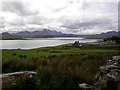
View up the Loch
by Kevin Philpott geograph for square NC4563 Tags: [top:Coastal] [top:Estuary, Marine] Looking up Loch Eriboll from the headland above Rubha Ruadh. The fine views were given added value by the grievous weather being visited on more southerly parts at the time!
|
Search took 0.00 secs, ( Page 1 2 3 4 5 6 7 8 ... next >> last ) [refine search]
· Login to view KML, GPX, or RSS versions of these results.Found these results useful? Please Donate
|