Your search for images, by A A Lang, in reverse Date Submitted order, returns
123 images:
( Page 1 2 3 4 5 6 7 8 ... next >> last ) [refine search]
[quick refine]

|
A New Pond
by A A Lang geograph for square NO1915 Category: Pond A new water feature has been created in 2010.
|
|
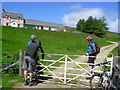
Friendly dog at Fealar
by A A Lang geograph for square NO0079 Category: Farmsteading The most remote farmstead in mainland Scotland.
|

|
Summit
by A A Lang geograph for square NO0076 Category: Track Top of Climb to Fearlar
|

|
Abernethy Linns
by A A Lang geograph for square NO1915 Category: Waterfalls In full spate.
|

|
Forest edge
by A A Lang geograph for square NO1914 Category: Forestry boundary Forest edge. Near turflundi.
|

|
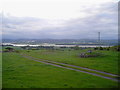
Summit
by A A Lang geograph for square NN9334 Category: Summit view Very hard ride to the top.
|
|
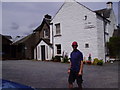
Inn at Chapelhill
by A A Lang for square NO0030 Category: Inn Fine wee boozer , it does nice food, check it out.
|
|
Cross and Tay
by A A Lang geograph for square NO2216 Category: Ancient site |
|
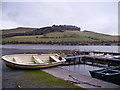
Fishing Boats
by A A Lang geograph for square NO2716 Category: Boat |

|
Making Tracks
by A A Lang geograph for square NO0149 Category: Track Deuchary Hill in the background.
|

|
Through the Arch
by A A Lang geograph for square NO1611 Category: Castle Looking towards Balvaird Farm
|

|
Balvaird
by A A Lang for square NO1611 Category: Castle Taken through a tumbled down wall.
|
|
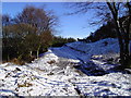
Track into Dunbarrow
by A A Lang geograph for square NO1813 Category: Track This is a recent bulldozed track into Dunbarrow Wood.
|

|
Thirl Stone
by A A Lang geograph for square NO1913 Category: Stone Taken from the North, looking south.
|

|
Felling Machine
by A A Lang geograph for square NO2015 Category: Forestry equipment Taken at Seven Gates trail junction.
|
Search took 0.00 secs, ( Page 1 2 3 4 5 6 7 8 ... next >> last ) [refine search]
· Login to view KML, GPX, or RSS versions of these results.Found these results useful? Please Donate
|