Grid reference NS8177
near to Greenhill, Falkirk, Scotland
Coverage
We have
21 images
in grid square NS8177
Contribute
Explore gridsquare NS8177
Surrounding area
Maps
Loading map... (JavaScript required)
Tip: Click the map to open the coverage map
Sample images
Breakdown list
A sample of 12 photos from 21
for NS8177
- View this square in the Browser >>>

|
Gateway to field of Donkeys at Wester Lochgreen
by Chris Upson
|

|
Farmland, Lochgreen
Picture taken from the fields to the south of Lochgreen
showing Wester Lochgreen Farm.
|
|
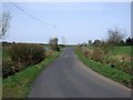
Road to Lochdrum |

|
Minor road shaded by trees
by Jim Smillie
Between Wester Lochgreen and Lochgreen.
|

|
Farmland, Lochgreen
by Richard Webb
|

|
Lochgreen Farm Burial Ground
18th century burial enclosure.
"A small walled family graveyard situated by Lochgreen Farm. The lintel above the entrance bears the inscription 17 WS AM & B 51. The first initial are those of William Spiers." - RCAHMS
|

|
Track leading down to Skipperton Burn
by Jim Smillie
Part of a right of way from Allandale.
|

|
Farmland, Lochgreen
Picture taken from the arable and sloping fields south of Lochgreen.
|

|
Farm track, Lochgreen
by Richard Webb
Track descending from wet fields and forestry on Garbethill Muir. Maps show it is continuous to Walton, but it becomes overgrown around Righead after leaving the new plantations.
|

|
You're a Donkey!
by Chris Upson
Donkeys at Wester Lochgreen
|

|
Lochgreen, Skipperton Burn |

|
Castlecary High Wood
A new heavy goods grade road has been laid into the plantation by a logging contractor. This road leads to Allandale (as sign posted) and also Walton Road.
|
Explore more images in this square: | View Filtering options | View all 21 images page by page >>> |
|